You are here: Home > Network List > TA - USArray Transportable Network (new EarthScope stations) Stations List
> Station H25A Fruitdale, SD, USA > Earthquake Result Viewer
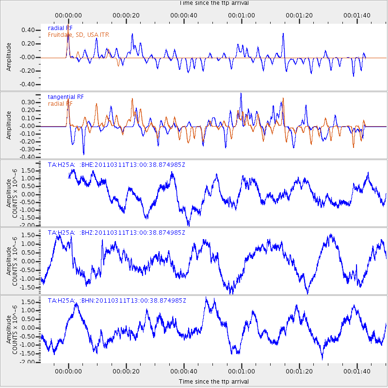
H25A Fruitdale, SD, USA - Earthquake Result Viewer
*The percent match for this event was below the threshold and hence no stack was calculated.
| Earthquake location: |
Near East Coast Of Honshu, Japan |
| Earthquake latitude/longitude: |
36.1/141.6 |
| Earthquake time(UTC): |
2011/03/11 (070) 12:49:02 GMT |
| Earthquake Depth: |
35 km |
| Earthquake Magnitude: |
5.6 MB |
| Earthquake Catalog/Contributor: |
WHDF/NEIC |
|
| Network: |
TA USArray Transportable Network (new EarthScope stations) |
| Station: |
H25A Fruitdale, SD, USA |
| Lat/Lon: |
44.62 N/103.60 W |
| Elevation: |
942 m |
|
| Distance: |
80.3 deg |
| Az: |
41.123 deg |
| Baz: |
311.804 deg |
| Ray Param: |
$rayparam |
*The percent match for this event was below the threshold and hence was not used in the summary stack. |
|
| Radial Match: |
66.160995 % |
| Radial Bump: |
400 |
| Transverse Match: |
54.490097 % |
| Transverse Bump: |
400 |
| SOD ConfigId: |
356183 |
| Insert Time: |
2011-08-16 06:13:06.768 +0000 |
| GWidth: |
2.5 |
| Max Bumps: |
400 |
| Tol: |
0.001 |
|
Signal To Noise
| Channel | StoN | STA | LTA |
| TA:H25A: :BHZ:20110311T13:00:38.874985Z | 1.2879497 | 9.0191577E-7 | 7.0027255E-7 |
| TA:H25A: :BHN:20110311T13:00:38.874985Z | 0.49998394 | 4.7345006E-7 | 9.469305E-7 |
| TA:H25A: :BHE:20110311T13:00:38.874985Z | 0.7420176 | 5.244769E-7 | 7.068254E-7 |
| Arrivals |
| Ps | |
| PpPs | |
| PsPs/PpSs | |


