You are here: Home > Network List > TA - USArray Transportable Network (new EarthScope stations) Stations List
> Station N35A Tabor, IA, USA > Earthquake Result Viewer
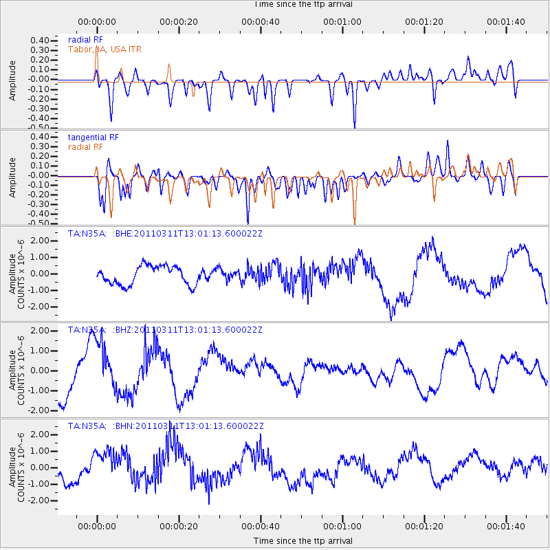
N35A Tabor, IA, USA - Earthquake Result Viewer
*The percent match for this event was below the threshold and hence no stack was calculated.
| Earthquake location: |
Near East Coast Of Honshu, Japan |
| Earthquake latitude/longitude: |
36.1/141.6 |
| Earthquake time(UTC): |
2011/03/11 (070) 12:49:02 GMT |
| Earthquake Depth: |
35 km |
| Earthquake Magnitude: |
5.6 MB |
| Earthquake Catalog/Contributor: |
WHDF/NEIC |
|
| Network: |
TA USArray Transportable Network (new EarthScope stations) |
| Station: |
N35A Tabor, IA, USA |
| Lat/Lon: |
40.86 N/95.64 W |
| Elevation: |
353 m |
|
| Distance: |
87.1 deg |
| Az: |
39.693 deg |
| Baz: |
317.035 deg |
| Ray Param: |
$rayparam |
*The percent match for this event was below the threshold and hence was not used in the summary stack. |
|
| Radial Match: |
72.006996 % |
| Radial Bump: |
400 |
| Transverse Match: |
67.46147 % |
| Transverse Bump: |
400 |
| SOD ConfigId: |
356183 |
| Insert Time: |
2011-08-16 06:32:55.786 +0000 |
| GWidth: |
2.5 |
| Max Bumps: |
400 |
| Tol: |
0.001 |
|
Signal To Noise
| Channel | StoN | STA | LTA |
| TA:N35A: :BHZ:20110311T13:01:13.600022Z | 0.9833823 | 1.2834289E-6 | 1.305117E-6 |
| TA:N35A: :BHN:20110311T13:01:13.600022Z | 1.1915398 | 1.5253238E-6 | 1.2801282E-6 |
| TA:N35A: :BHE:20110311T13:01:13.600022Z | 0.5663457 | 3.1674716E-7 | 5.592824E-7 |
| Arrivals |
| Ps | |
| PpPs | |
| PsPs/PpSs | |


