You are here: Home > Network List > CI - Caltech Regional Seismic Network Stations List
> Station MPM Manuel Prospect Mine, California, USA > Earthquake Result Viewer
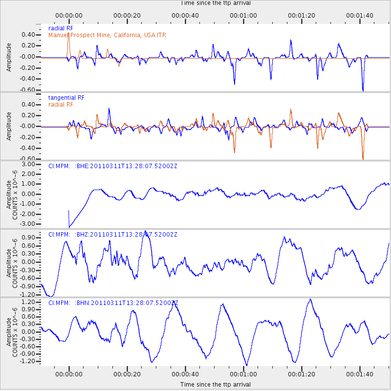
MPM Manuel Prospect Mine, California, USA - Earthquake Result Viewer
*The percent match for this event was below the threshold and hence no stack was calculated.
| Earthquake location: |
Near East Coast Of Honshu, Japan |
| Earthquake latitude/longitude: |
36.4/141.7 |
| Earthquake time(UTC): |
2011/03/11 (070) 13:16:51 GMT |
| Earthquake Depth: |
58 km |
| Earthquake Magnitude: |
5.6 MB |
| Earthquake Catalog/Contributor: |
WHDF/NEIC |
|
| Network: |
CI Caltech Regional Seismic Network |
| Station: |
MPM Manuel Prospect Mine, California, USA |
| Lat/Lon: |
36.06 N/117.49 W |
| Elevation: |
185 m |
|
| Distance: |
77.1 deg |
| Az: |
54.761 deg |
| Baz: |
305.559 deg |
| Ray Param: |
$rayparam |
*The percent match for this event was below the threshold and hence was not used in the summary stack. |
|
| Radial Match: |
55.442364 % |
| Radial Bump: |
239 |
| Transverse Match: |
53.665115 % |
| Transverse Bump: |
385 |
| SOD ConfigId: |
356183 |
| Insert Time: |
2011-08-16 08:38:30.609 +0000 |
| GWidth: |
2.5 |
| Max Bumps: |
400 |
| Tol: |
0.001 |
|
Signal To Noise
| Channel | StoN | STA | LTA |
| CI:MPM: :BHZ:20110311T13:28:07.52002Z | 0.5077396 | 4.1334022E-7 | 8.1407916E-7 |
| CI:MPM: :BHN:20110311T13:28:07.52002Z | 0.8791461 | 3.6151587E-7 | 4.1121248E-7 |
| CI:MPM: :BHE:20110311T13:28:07.52002Z | 0.82561505 | 8.4410044E-7 | 1.0223898E-6 |
| Arrivals |
| Ps | |
| PpPs | |
| PsPs/PpSs | |


