You are here: Home > Network List > KN - Kyrgyz Seismic Telemetry Network Stations List
> Station TKM2 KN.TKM2 > Earthquake Result Viewer
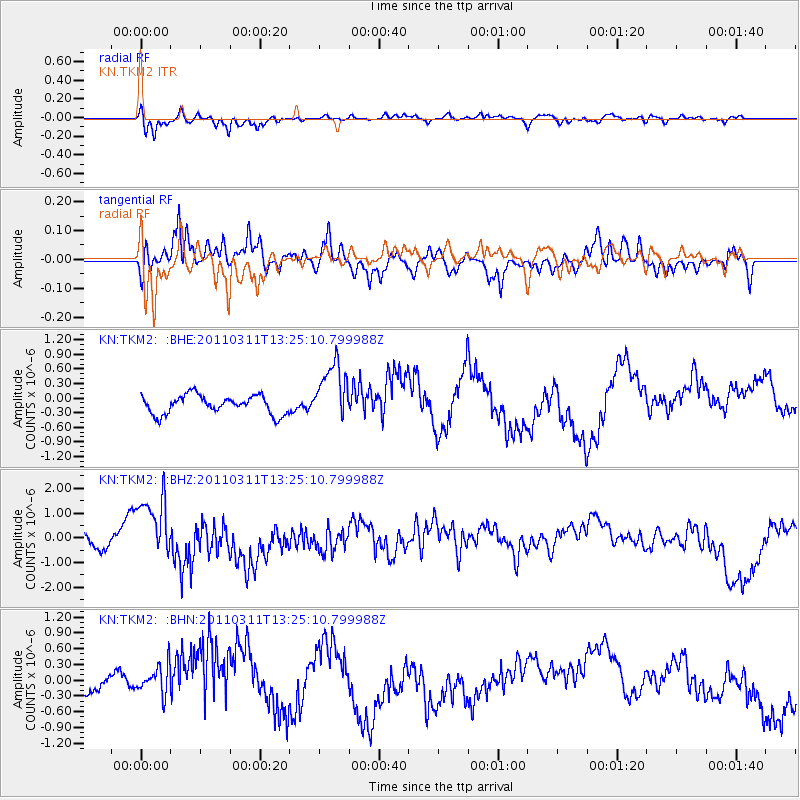
TKM2 KN.TKM2 - Earthquake Result Viewer
*The percent match for this event was below the threshold and hence no stack was calculated.
| Earthquake location: |
Near East Coast Of Honshu, Japan |
| Earthquake latitude/longitude: |
36.4/141.7 |
| Earthquake time(UTC): |
2011/03/11 (070) 13:16:51 GMT |
| Earthquake Depth: |
58 km |
| Earthquake Magnitude: |
5.6 MB |
| Earthquake Catalog/Contributor: |
WHDF/NEIC |
|
| Network: |
KN Kyrgyz Seismic Telemetry Network |
| Station: |
TKM2 KN.TKM2 |
| Lat/Lon: |
42.92 N/75.60 E |
| Elevation: |
2020 m |
|
| Distance: |
50.2 deg |
| Az: |
298.99 deg |
| Baz: |
73.958 deg |
| Ray Param: |
$rayparam |
*The percent match for this event was below the threshold and hence was not used in the summary stack. |
|
| Radial Match: |
70.09055 % |
| Radial Bump: |
382 |
| Transverse Match: |
66.345116 % |
| Transverse Bump: |
400 |
| SOD ConfigId: |
356183 |
| Insert Time: |
2011-08-16 08:52:27.791 +0000 |
| GWidth: |
2.5 |
| Max Bumps: |
400 |
| Tol: |
0.001 |
|
Signal To Noise
| Channel | StoN | STA | LTA |
| KN:TKM2: :BHZ:20110311T13:25:10.799988Z | 2.0630264 | 1.5411268E-6 | 7.4702234E-7 |
| KN:TKM2: :BHN:20110311T13:25:10.799988Z | 1.2232132 | 5.1240096E-7 | 4.1889754E-7 |
| KN:TKM2: :BHE:20110311T13:25:10.799988Z | 3.1585007 | 6.078967E-7 | 1.9246369E-7 |
| Arrivals |
| Ps | |
| PpPs | |
| PsPs/PpSs | |


