You are here: Home > Network List > TA - USArray Transportable Network (new EarthScope stations) Stations List
> Station S37A Fort Scott, KS, USA > Earthquake Result Viewer
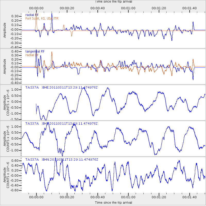
S37A Fort Scott, KS, USA - Earthquake Result Viewer
*The percent match for this event was below the threshold and hence no stack was calculated.
| Earthquake location: |
Near East Coast Of Honshu, Japan |
| Earthquake latitude/longitude: |
36.4/141.7 |
| Earthquake time(UTC): |
2011/03/11 (070) 13:16:51 GMT |
| Earthquake Depth: |
58 km |
| Earthquake Magnitude: |
5.6 MB |
| Earthquake Catalog/Contributor: |
WHDF/NEIC |
|
| Network: |
TA USArray Transportable Network (new EarthScope stations) |
| Station: |
S37A Fort Scott, KS, USA |
| Lat/Lon: |
37.76 N/94.83 W |
| Elevation: |
260 m |
|
| Distance: |
89.6 deg |
| Az: |
41.412 deg |
| Baz: |
317.655 deg |
| Ray Param: |
$rayparam |
*The percent match for this event was below the threshold and hence was not used in the summary stack. |
|
| Radial Match: |
57.654415 % |
| Radial Bump: |
400 |
| Transverse Match: |
76.49562 % |
| Transverse Bump: |
400 |
| SOD ConfigId: |
356183 |
| Insert Time: |
2011-08-16 09:31:46.019 +0000 |
| GWidth: |
2.5 |
| Max Bumps: |
400 |
| Tol: |
0.001 |
|
Signal To Noise
| Channel | StoN | STA | LTA |
| TA:S37A: :BHZ:20110311T13:29:11.474976Z | 1.7326002 | 6.4964655E-7 | 3.7495468E-7 |
| TA:S37A: :BHN:20110311T13:29:11.474976Z | 0.8017581 | 2.924877E-7 | 3.648079E-7 |
| TA:S37A: :BHE:20110311T13:29:11.474976Z | 2.0155246 | 1.3379588E-6 | 6.6382654E-7 |
| Arrivals |
| Ps | |
| PpPs | |
| PsPs/PpSs | |


