You are here: Home > Network List > CI - Caltech Regional Seismic Network Stations List
> Station FUR Furnace Creek, CA, USA > Earthquake Result Viewer
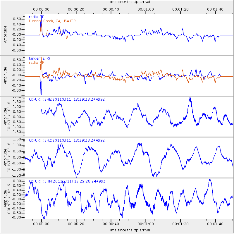
FUR Furnace Creek, CA, USA - Earthquake Result Viewer
*The percent match for this event was below the threshold and hence no stack was calculated.
| Earthquake location: |
Off East Coast Of Honshu, Japan |
| Earthquake latitude/longitude: |
37.6/142.8 |
| Earthquake time(UTC): |
2011/03/11 (070) 13:18:16 GMT |
| Earthquake Depth: |
35 km |
| Earthquake Magnitude: |
5.5 MB |
| Earthquake Catalog/Contributor: |
WHDF/NEIC |
|
| Network: |
CI Caltech Regional Seismic Network |
| Station: |
FUR Furnace Creek, CA, USA |
| Lat/Lon: |
36.47 N/116.86 W |
| Elevation: |
-37.0 m |
|
| Distance: |
75.8 deg |
| Az: |
54.881 deg |
| Baz: |
306.272 deg |
| Ray Param: |
$rayparam |
*The percent match for this event was below the threshold and hence was not used in the summary stack. |
|
| Radial Match: |
69.70041 % |
| Radial Bump: |
400 |
| Transverse Match: |
50.46835 % |
| Transverse Bump: |
400 |
| SOD ConfigId: |
356183 |
| Insert Time: |
2011-08-16 10:32:11.472 +0000 |
| GWidth: |
2.5 |
| Max Bumps: |
400 |
| Tol: |
0.001 |
|
Signal To Noise
| Channel | StoN | STA | LTA |
| CI:FUR: :BHZ:20110311T13:29:28.24499Z | 0.6244506 | 4.2307596E-7 | 6.7751705E-7 |
| CI:FUR: :BHN:20110311T13:29:28.24499Z | 0.647896 | 4.9224764E-7 | 7.597634E-7 |
| CI:FUR: :BHE:20110311T13:29:28.24499Z | 1.0757887 | 7.2317175E-7 | 6.722247E-7 |
| Arrivals |
| Ps | |
| PpPs | |
| PsPs/PpSs | |


