You are here: Home > Network List > TA - USArray Transportable Network (new EarthScope stations) Stations List
> Station J01E Myrtle Point, OR, USA > Earthquake Result Viewer
J01E Myrtle Point, OR, USA - Earthquake Result Viewer
*The percent match for this event was below the threshold and hence no stack was calculated.
| Earthquake location: |
Xizang |
| Earthquake latitude/longitude: |
33.9/89.2 |
| Earthquake time(UTC): |
2014/02/11 (042) 01:15:27 GMT |
| Earthquake Depth: |
12 km |
| Earthquake Magnitude: |
5.2 MW |
| Earthquake Catalog/Contributor: |
ISC/ISC |
|
| Network: |
TA USArray Transportable Network (new EarthScope stations) |
| Station: |
J01E Myrtle Point, OR, USA |
| Lat/Lon: |
43.16 N/123.93 W |
| Elevation: |
128 m |
|
| Distance: |
97.6 deg |
| Az: |
23.778 deg |
| Baz: |
332.713 deg |
| Ray Param: |
$rayparam |
*The percent match for this event was below the threshold and hence was not used in the summary stack. |
|
| Radial Match: |
48.61661 % |
| Radial Bump: |
400 |
| Transverse Match: |
61.357956 % |
| Transverse Bump: |
400 |
| SOD ConfigId: |
3390531 |
| Insert Time: |
2019-04-10 07:44:15.193 +0000 |
| GWidth: |
2.5 |
| Max Bumps: |
400 |
| Tol: |
0.001 |
|
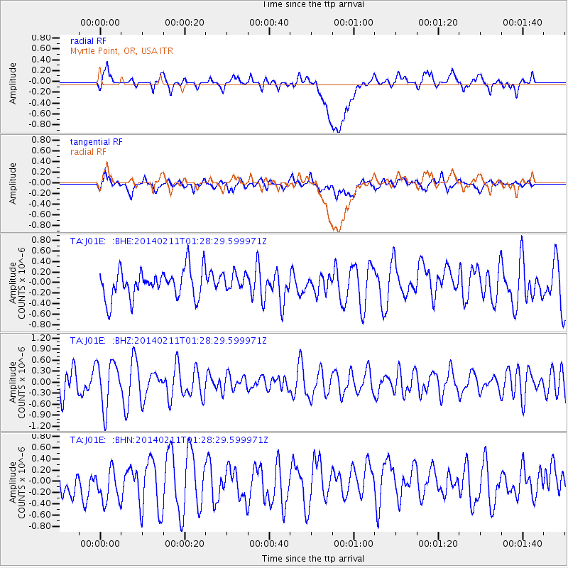
Signal To Noise
| Channel | StoN | STA | LTA |
| TA:J01E: :BHZ:20140211T01:28:29.599971Z | 2.0143442 | 6.282715E-7 | 3.118988E-7 |
| TA:J01E: :BHN:20140211T01:28:29.599971Z | 0.9020345 | 4.6825238E-7 | 5.1910695E-7 |
| TA:J01E: :BHE:20140211T01:28:29.599971Z | 0.59032506 | 1.6228847E-7 | 2.7491373E-7 |
| Arrivals |
| Ps | |
| PpPs | |
| PsPs/PpSs | |


