You are here: Home > Network List > TA - USArray Transportable Network (new EarthScope stations) Stations List
> Station X33A Lawton, OK, USA > Earthquake Result Viewer
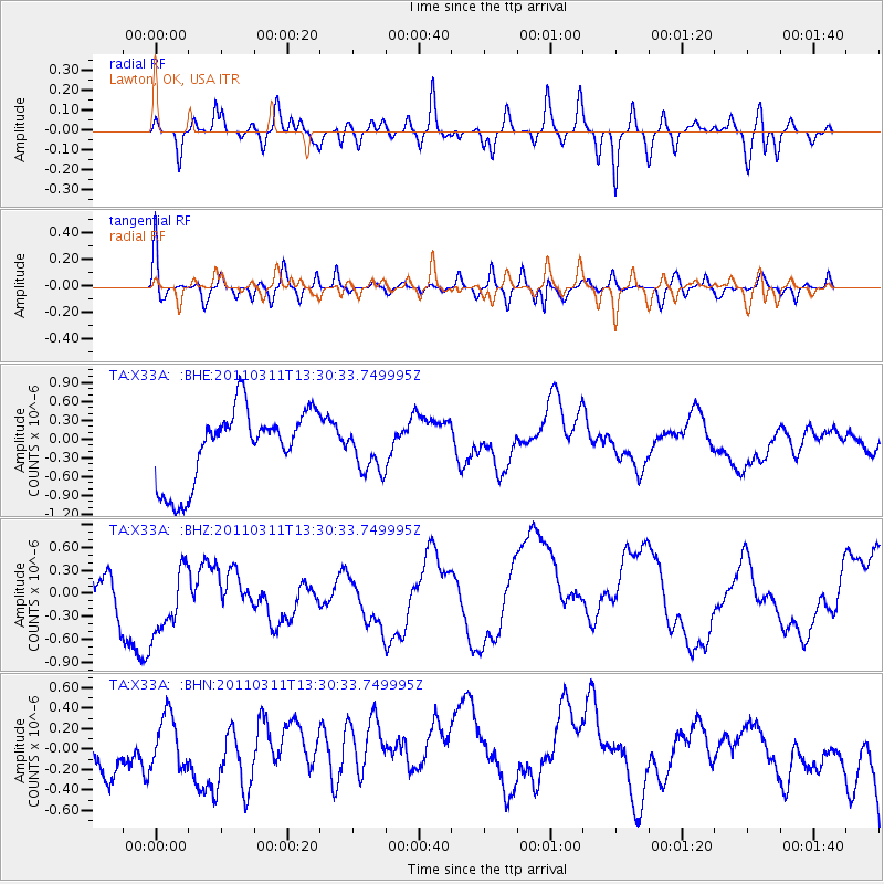
X33A Lawton, OK, USA - Earthquake Result Viewer
*The percent match for this event was below the threshold and hence no stack was calculated.
| Earthquake location: |
Off East Coast Of Honshu, Japan |
| Earthquake latitude/longitude: |
37.6/142.8 |
| Earthquake time(UTC): |
2011/03/11 (070) 13:18:16 GMT |
| Earthquake Depth: |
35 km |
| Earthquake Magnitude: |
5.5 MB |
| Earthquake Catalog/Contributor: |
WHDF/NEIC |
|
| Network: |
TA USArray Transportable Network (new EarthScope stations) |
| Station: |
X33A Lawton, OK, USA |
| Lat/Lon: |
34.54 N/98.50 W |
| Elevation: |
346 m |
|
| Distance: |
88.4 deg |
| Az: |
46.432 deg |
| Baz: |
315.783 deg |
| Ray Param: |
$rayparam |
*The percent match for this event was below the threshold and hence was not used in the summary stack. |
|
| Radial Match: |
38.69582 % |
| Radial Bump: |
400 |
| Transverse Match: |
56.198914 % |
| Transverse Bump: |
400 |
| SOD ConfigId: |
356183 |
| Insert Time: |
2011-08-16 11:57:18.117 +0000 |
| GWidth: |
2.5 |
| Max Bumps: |
400 |
| Tol: |
0.001 |
|
Signal To Noise
| Channel | StoN | STA | LTA |
| TA:X33A: :BHZ:20110311T13:30:33.749995Z | 0.93800247 | 8.0999354E-7 | 8.6353026E-7 |
| TA:X33A: :BHN:20110311T13:30:33.749995Z | 1.3537823 | 3.2653006E-7 | 2.4119836E-7 |
| TA:X33A: :BHE:20110311T13:30:33.749995Z | 0.5782731 | 3.4075163E-7 | 5.8925724E-7 |
| Arrivals |
| Ps | |
| PpPs | |
| PsPs/PpSs | |


