You are here: Home > Network List > TA - USArray Transportable Network (new EarthScope stations) Stations List
> Station R30A Dighton, KS, USA > Earthquake Result Viewer
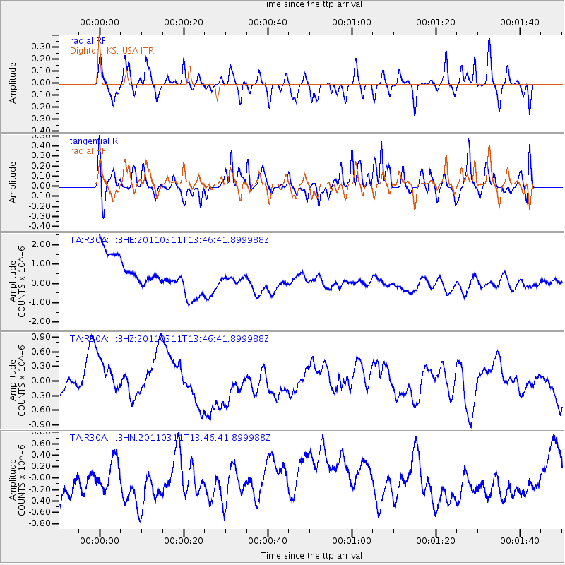
R30A Dighton, KS, USA - Earthquake Result Viewer
*The percent match for this event was below the threshold and hence no stack was calculated.
| Earthquake location: |
Near East Coast Of Honshu, Japan |
| Earthquake latitude/longitude: |
36.2/141.8 |
| Earthquake time(UTC): |
2011/03/11 (070) 13:34:30 GMT |
| Earthquake Depth: |
4.7 km |
| Earthquake Magnitude: |
5.5 MB |
| Earthquake Catalog/Contributor: |
WHDF/NEIC |
|
| Network: |
TA USArray Transportable Network (new EarthScope stations) |
| Station: |
R30A Dighton, KS, USA |
| Lat/Lon: |
38.28 N/100.28 W |
| Elevation: |
776 m |
|
| Distance: |
86.3 deg |
| Az: |
44.191 deg |
| Baz: |
314.21 deg |
| Ray Param: |
$rayparam |
*The percent match for this event was below the threshold and hence was not used in the summary stack. |
|
| Radial Match: |
50.621 % |
| Radial Bump: |
400 |
| Transverse Match: |
37.740395 % |
| Transverse Bump: |
351 |
| SOD ConfigId: |
356183 |
| Insert Time: |
2011-08-16 13:58:32.856 +0000 |
| GWidth: |
2.5 |
| Max Bumps: |
400 |
| Tol: |
0.001 |
|
Signal To Noise
| Channel | StoN | STA | LTA |
| TA:R30A: :BHZ:20110311T13:46:41.899988Z | 1.1829883 | 4.812945E-7 | 4.0684637E-7 |
| TA:R30A: :BHN:20110311T13:46:41.899988Z | 0.51760006 | 3.6190997E-7 | 6.9920776E-7 |
| TA:R30A: :BHE:20110311T13:46:41.899988Z | 0.20835239 | 1.724645E-7 | 8.2775387E-7 |
| Arrivals |
| Ps | |
| PpPs | |
| PsPs/PpSs | |


