You are here: Home > Network List > TA - USArray Transportable Network (new EarthScope stations) Stations List
> Station 534A Blanco, TX, USA > Earthquake Result Viewer
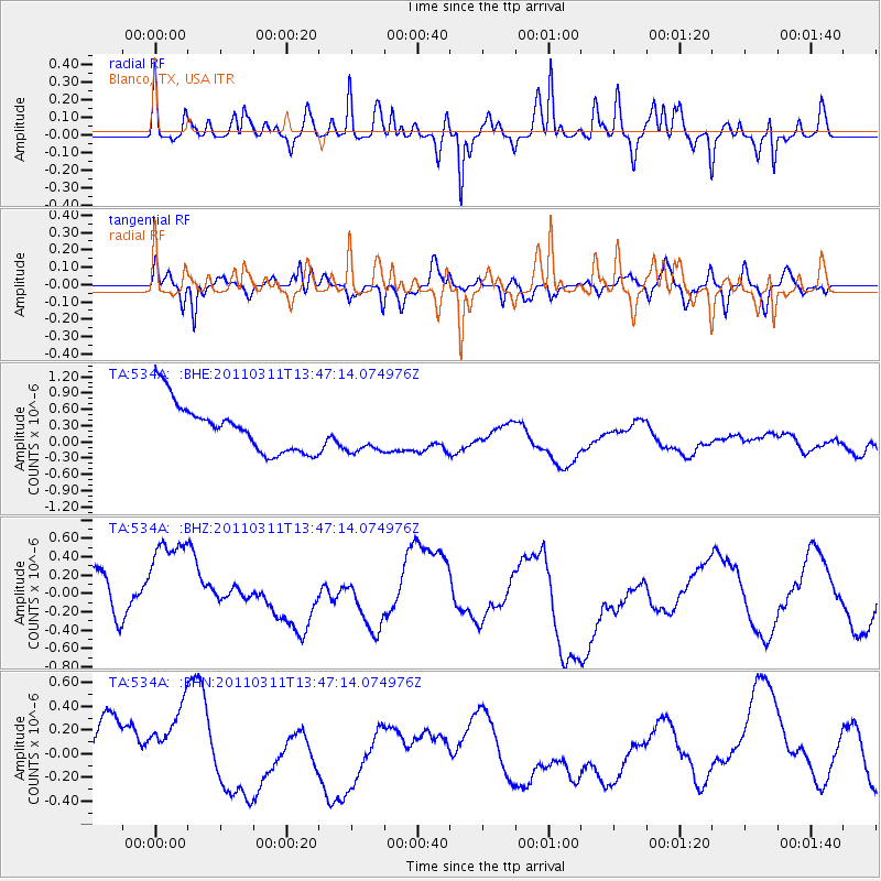
534A Blanco, TX, USA - Earthquake Result Viewer
*The percent match for this event was below the threshold and hence no stack was calculated.
| Earthquake location: |
Near East Coast Of Honshu, Japan |
| Earthquake latitude/longitude: |
36.2/141.8 |
| Earthquake time(UTC): |
2011/03/11 (070) 13:34:30 GMT |
| Earthquake Depth: |
4.7 km |
| Earthquake Magnitude: |
5.5 MB |
| Earthquake Catalog/Contributor: |
WHDF/NEIC |
|
| Network: |
TA USArray Transportable Network (new EarthScope stations) |
| Station: |
534A Blanco, TX, USA |
| Lat/Lon: |
30.03 N/98.48 W |
| Elevation: |
461 m |
|
| Distance: |
93.2 deg |
| Az: |
48.987 deg |
| Baz: |
315.243 deg |
| Ray Param: |
$rayparam |
*The percent match for this event was below the threshold and hence was not used in the summary stack. |
|
| Radial Match: |
49.17898 % |
| Radial Bump: |
332 |
| Transverse Match: |
51.303707 % |
| Transverse Bump: |
400 |
| SOD ConfigId: |
356183 |
| Insert Time: |
2011-08-16 14:17:50.096 +0000 |
| GWidth: |
2.5 |
| Max Bumps: |
400 |
| Tol: |
0.001 |
|
Signal To Noise
| Channel | StoN | STA | LTA |
| TA:534A: :BHZ:20110311T13:47:14.074976Z | 2.0366626 | 6.932785E-7 | 3.4039928E-7 |
| TA:534A: :BHN:20110311T13:47:14.074976Z | 1.7259166 | 4.753314E-7 | 2.754081E-7 |
| TA:534A: :BHE:20110311T13:47:14.074976Z | 0.8350663 | 3.7561222E-7 | 4.4979927E-7 |
| Arrivals |
| Ps | |
| PpPs | |
| PsPs/PpSs | |


