You are here: Home > Network List > CI - Caltech Regional Seismic Network Stations List
> Station MPM Manuel Prospect Mine, California, USA > Earthquake Result Viewer
MPM Manuel Prospect Mine, California, USA - Earthquake Result Viewer
*The percent match for this event was below the threshold and hence no stack was calculated.
| Earthquake location: |
Off East Coast Of Honshu, Japan |
| Earthquake latitude/longitude: |
39.0/144.1 |
| Earthquake time(UTC): |
2011/03/11 (070) 13:43:09 GMT |
| Earthquake Depth: |
25 km |
| Earthquake Magnitude: |
5.7 MB |
| Earthquake Catalog/Contributor: |
WHDF/NEIC |
|
| Network: |
CI Caltech Regional Seismic Network |
| Station: |
MPM Manuel Prospect Mine, California, USA |
| Lat/Lon: |
36.06 N/117.49 W |
| Elevation: |
185 m |
|
| Distance: |
74.0 deg |
| Az: |
56.492 deg |
| Baz: |
306.684 deg |
| Ray Param: |
$rayparam |
*The percent match for this event was below the threshold and hence was not used in the summary stack. |
|
| Radial Match: |
51.976677 % |
| Radial Bump: |
400 |
| Transverse Match: |
58.87193 % |
| Transverse Bump: |
337 |
| SOD ConfigId: |
356183 |
| Insert Time: |
2011-08-16 15:53:25.175 +0000 |
| GWidth: |
2.5 |
| Max Bumps: |
400 |
| Tol: |
0.001 |
|
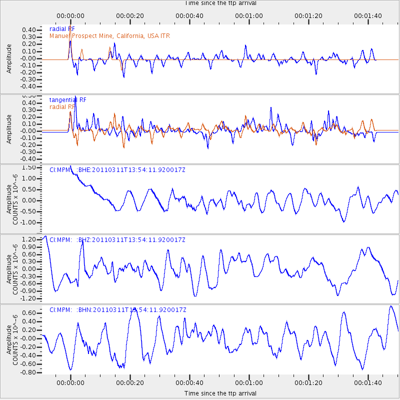
Signal To Noise
| Channel | StoN | STA | LTA |
| CI:MPM: :BHZ:20110311T13:54:11.920017Z | 0.9854364 | 5.9199556E-7 | 6.0074456E-7 |
| CI:MPM: :BHN:20110311T13:54:11.920017Z | 0.9038284 | 7.450657E-7 | 8.2434417E-7 |
| CI:MPM: :BHE:20110311T13:54:11.920017Z | 0.9095705 | 4.7414025E-7 | 5.212793E-7 |
| Arrivals |
| Ps | |
| PpPs | |
| PsPs/PpSs | |


