You are here: Home > Network List > TA - USArray Transportable Network (new EarthScope stations) Stations List
> Station S29A Ulysses, KS, USA > Earthquake Result Viewer
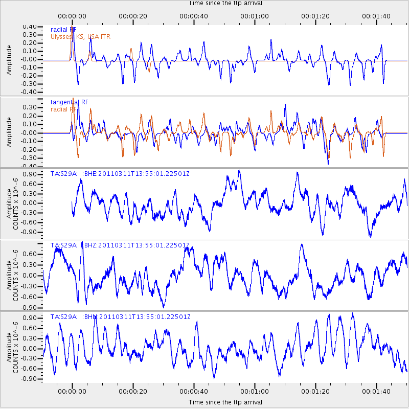
S29A Ulysses, KS, USA - Earthquake Result Viewer
*The percent match for this event was below the threshold and hence no stack was calculated.
| Earthquake location: |
Off East Coast Of Honshu, Japan |
| Earthquake latitude/longitude: |
39.0/144.1 |
| Earthquake time(UTC): |
2011/03/11 (070) 13:43:09 GMT |
| Earthquake Depth: |
25 km |
| Earthquake Magnitude: |
5.7 MB |
| Earthquake Catalog/Contributor: |
WHDF/NEIC |
|
| Network: |
TA USArray Transportable Network (new EarthScope stations) |
| Station: |
S29A Ulysses, KS, USA |
| Lat/Lon: |
37.62 N/101.12 W |
| Elevation: |
931 m |
|
| Distance: |
83.0 deg |
| Az: |
46.592 deg |
| Baz: |
314.52 deg |
| Ray Param: |
$rayparam |
*The percent match for this event was below the threshold and hence was not used in the summary stack. |
|
| Radial Match: |
56.016922 % |
| Radial Bump: |
348 |
| Transverse Match: |
62.52916 % |
| Transverse Bump: |
400 |
| SOD ConfigId: |
356183 |
| Insert Time: |
2011-08-16 16:39:31.302 +0000 |
| GWidth: |
2.5 |
| Max Bumps: |
400 |
| Tol: |
0.001 |
|
Signal To Noise
| Channel | StoN | STA | LTA |
| TA:S29A: :BHZ:20110311T13:55:01.22501Z | 0.95775574 | 5.372127E-7 | 5.609079E-7 |
| TA:S29A: :BHN:20110311T13:55:01.22501Z | 1.3157324 | 4.4681835E-7 | 3.3959668E-7 |
| TA:S29A: :BHE:20110311T13:55:01.22501Z | 0.9204311 | 2.8282588E-7 | 3.0727546E-7 |
| Arrivals |
| Ps | |
| PpPs | |
| PsPs/PpSs | |


