You are here: Home > Network List > TA - USArray Transportable Network (new EarthScope stations) Stations List
> Station R32A Long Quarter, Great Bend, KS, USA > Earthquake Result Viewer
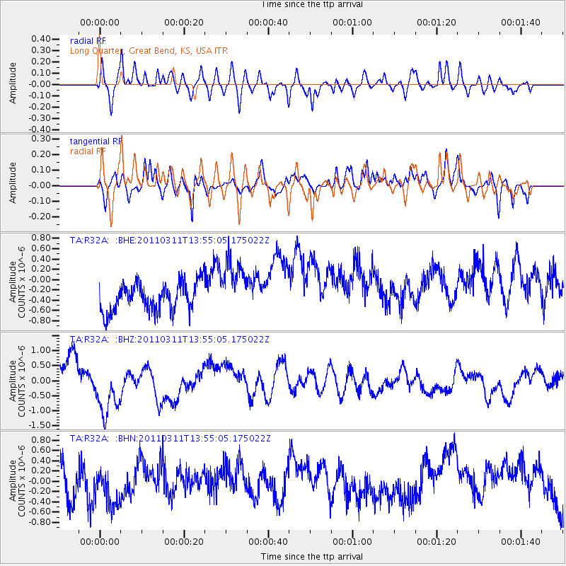
R32A Long Quarter, Great Bend, KS, USA - Earthquake Result Viewer
*The percent match for this event was below the threshold and hence no stack was calculated.
| Earthquake location: |
Off East Coast Of Honshu, Japan |
| Earthquake latitude/longitude: |
39.0/144.1 |
| Earthquake time(UTC): |
2011/03/11 (070) 13:43:09 GMT |
| Earthquake Depth: |
25 km |
| Earthquake Magnitude: |
5.7 MB |
| Earthquake Catalog/Contributor: |
WHDF/NEIC |
|
| Network: |
TA USArray Transportable Network (new EarthScope stations) |
| Station: |
R32A Long Quarter, Great Bend, KS, USA |
| Lat/Lon: |
38.42 N/98.71 W |
| Elevation: |
573 m |
|
| Distance: |
83.8 deg |
| Az: |
44.667 deg |
| Baz: |
315.775 deg |
| Ray Param: |
$rayparam |
*The percent match for this event was below the threshold and hence was not used in the summary stack. |
|
| Radial Match: |
60.441532 % |
| Radial Bump: |
400 |
| Transverse Match: |
51.82818 % |
| Transverse Bump: |
390 |
| SOD ConfigId: |
356183 |
| Insert Time: |
2011-08-16 16:58:33.390 +0000 |
| GWidth: |
2.5 |
| Max Bumps: |
400 |
| Tol: |
0.001 |
|
Signal To Noise
| Channel | StoN | STA | LTA |
| TA:R32A: :BHZ:20110311T13:55:05.175022Z | 1.4264001 | 8.575802E-7 | 6.0121994E-7 |
| TA:R32A: :BHN:20110311T13:55:05.175022Z | 1.0502901 | 3.0089728E-7 | 2.8648967E-7 |
| TA:R32A: :BHE:20110311T13:55:05.175022Z | 1.9844854 | 5.4743987E-7 | 2.7585986E-7 |
| Arrivals |
| Ps | |
| PpPs | |
| PsPs/PpSs | |


