You are here: Home > Network List > TA - USArray Transportable Network (new EarthScope stations) Stations List
> Station C38A Sawbill Landing (USFS), Superior Nat. Forest, MN, > Earthquake Result Viewer
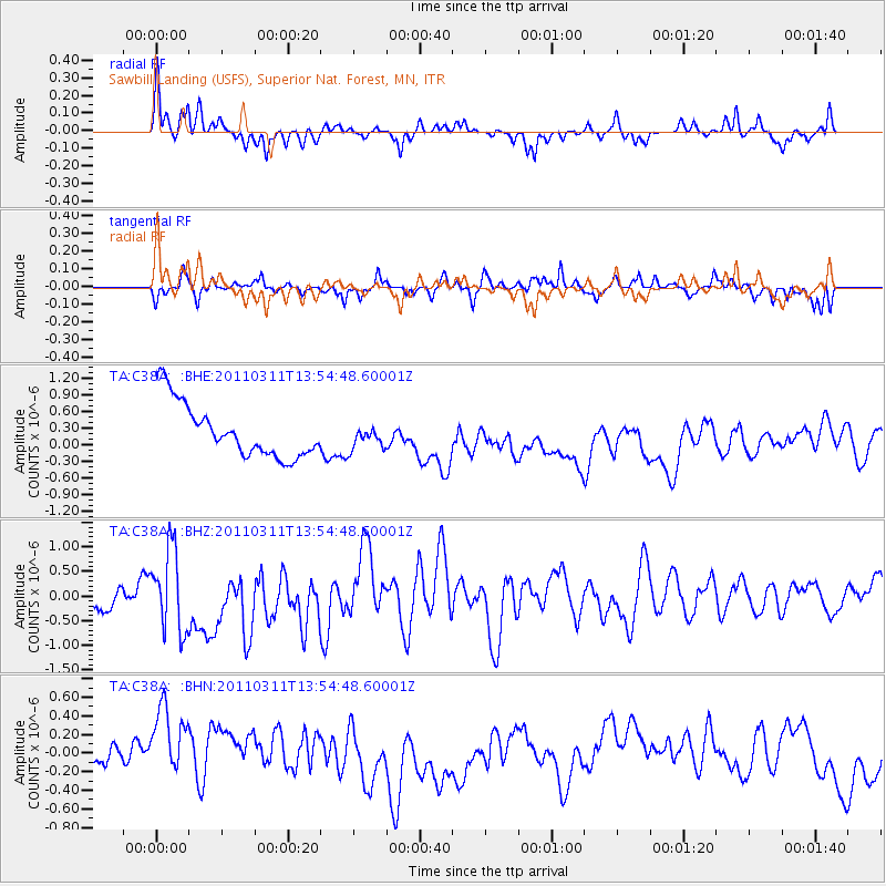
C38A Sawbill Landing (USFS), Superior Nat. Forest, MN, - Earthquake Result Viewer
*The percent match for this event was below the threshold and hence no stack was calculated.
| Earthquake location: |
Off East Coast Of Honshu, Japan |
| Earthquake latitude/longitude: |
39.0/144.1 |
| Earthquake time(UTC): |
2011/03/11 (070) 13:43:09 GMT |
| Earthquake Depth: |
25 km |
| Earthquake Magnitude: |
5.7 MB |
| Earthquake Catalog/Contributor: |
WHDF/NEIC |
|
| Network: |
TA USArray Transportable Network (new EarthScope stations) |
| Station: |
C38A Sawbill Landing (USFS), Superior Nat. Forest, MN, |
| Lat/Lon: |
47.72 N/91.27 W |
| Elevation: |
498 m |
|
| Distance: |
80.6 deg |
| Az: |
34.291 deg |
| Baz: |
319.442 deg |
| Ray Param: |
$rayparam |
*The percent match for this event was below the threshold and hence was not used in the summary stack. |
|
| Radial Match: |
59.251907 % |
| Radial Bump: |
290 |
| Transverse Match: |
39.176983 % |
| Transverse Bump: |
292 |
| SOD ConfigId: |
356183 |
| Insert Time: |
2011-08-16 17:31:55.737 +0000 |
| GWidth: |
2.5 |
| Max Bumps: |
400 |
| Tol: |
0.001 |
|
Signal To Noise
| Channel | StoN | STA | LTA |
| TA:C38A: :BHZ:20110311T13:54:48.60001Z | 2.0503933 | 8.2465317E-7 | 4.0219265E-7 |
| TA:C38A: :BHN:20110311T13:54:48.60001Z | 1.6016619 | 5.478108E-7 | 3.420265E-7 |
| TA:C38A: :BHE:20110311T13:54:48.60001Z | 0.42569202 | 2.0857657E-7 | 4.899706E-7 |
| Arrivals |
| Ps | |
| PpPs | |
| PsPs/PpSs | |


