You are here: Home > Network List > TA - USArray Transportable Network (new EarthScope stations) Stations List
> Station L37A Phoenix Point, Boone, IA, USA > Earthquake Result Viewer
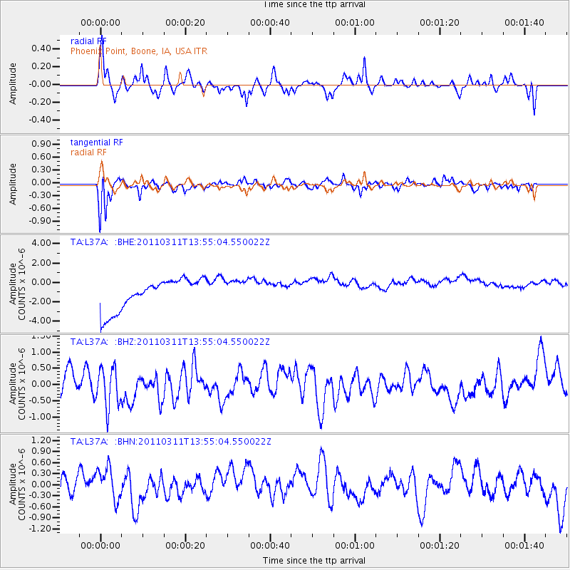
L37A Phoenix Point, Boone, IA, USA - Earthquake Result Viewer
*The percent match for this event was below the threshold and hence no stack was calculated.
| Earthquake location: |
Off East Coast Of Honshu, Japan |
| Earthquake latitude/longitude: |
39.0/144.1 |
| Earthquake time(UTC): |
2011/03/11 (070) 13:43:09 GMT |
| Earthquake Depth: |
25 km |
| Earthquake Magnitude: |
5.7 MB |
| Earthquake Catalog/Contributor: |
WHDF/NEIC |
|
| Network: |
TA USArray Transportable Network (new EarthScope stations) |
| Station: |
L37A Phoenix Point, Boone, IA, USA |
| Lat/Lon: |
42.12 N/93.75 W |
| Elevation: |
312 m |
|
| Distance: |
83.7 deg |
| Az: |
39.342 deg |
| Baz: |
318.386 deg |
| Ray Param: |
$rayparam |
*The percent match for this event was below the threshold and hence was not used in the summary stack. |
|
| Radial Match: |
68.11686 % |
| Radial Bump: |
369 |
| Transverse Match: |
65.47828 % |
| Transverse Bump: |
324 |
| SOD ConfigId: |
356183 |
| Insert Time: |
2011-08-16 17:39:31.052 +0000 |
| GWidth: |
2.5 |
| Max Bumps: |
400 |
| Tol: |
0.001 |
|
Signal To Noise
| Channel | StoN | STA | LTA |
| TA:L37A: :BHZ:20110311T13:55:04.550022Z | 0.796657 | 6.233179E-7 | 7.824168E-7 |
| TA:L37A: :BHN:20110311T13:55:04.550022Z | 1.3607508 | 6.1217474E-7 | 4.4988016E-7 |
| TA:L37A: :BHE:20110311T13:55:04.550022Z | 0.77533734 | 1.2256476E-6 | 1.5807926E-6 |
| Arrivals |
| Ps | |
| PpPs | |
| PsPs/PpSs | |


