You are here: Home > Network List > US - United States National Seismic Network Stations List
> Station EGMT Eagleton, Montana, USA > Earthquake Result Viewer
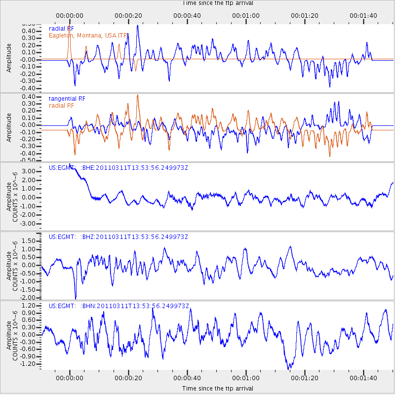
EGMT Eagleton, Montana, USA - Earthquake Result Viewer
*The percent match for this event was below the threshold and hence no stack was calculated.
| Earthquake location: |
Off East Coast Of Honshu, Japan |
| Earthquake latitude/longitude: |
39.0/144.1 |
| Earthquake time(UTC): |
2011/03/11 (070) 13:43:09 GMT |
| Earthquake Depth: |
25 km |
| Earthquake Magnitude: |
5.7 MB |
| Earthquake Catalog/Contributor: |
WHDF/NEIC |
|
| Network: |
US United States National Seismic Network |
| Station: |
EGMT Eagleton, Montana, USA |
| Lat/Lon: |
48.02 N/109.75 W |
| Elevation: |
1055 m |
|
| Distance: |
71.4 deg |
| Az: |
42.883 deg |
| Baz: |
307.813 deg |
| Ray Param: |
$rayparam |
*The percent match for this event was below the threshold and hence was not used in the summary stack. |
|
| Radial Match: |
56.174553 % |
| Radial Bump: |
351 |
| Transverse Match: |
62.424564 % |
| Transverse Bump: |
400 |
| SOD ConfigId: |
356183 |
| Insert Time: |
2011-08-16 18:03:36.202 +0000 |
| GWidth: |
2.5 |
| Max Bumps: |
400 |
| Tol: |
0.001 |
|
Signal To Noise
| Channel | StoN | STA | LTA |
| US:EGMT: :BHZ:20110311T13:53:56.249973Z | 1.4442018 | 6.949947E-7 | 4.81231E-7 |
| US:EGMT: :BHN:20110311T13:53:56.249973Z | 1.3805333 | 5.586578E-7 | 4.046681E-7 |
| US:EGMT: :BHE:20110311T13:53:56.249973Z | 0.85287625 | 1.1027867E-6 | 1.2930207E-6 |
| Arrivals |
| Ps | |
| PpPs | |
| PsPs/PpSs | |


