You are here: Home > Network List > TA - USArray Transportable Network (new EarthScope stations) Stations List
> Station H17A Grant Village (NPS), Yellowstone Nt. Park, WY, USA > Earthquake Result Viewer
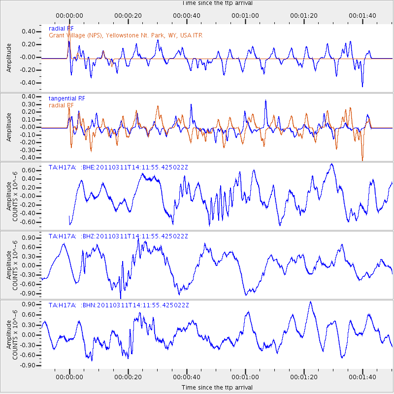
H17A Grant Village (NPS), Yellowstone Nt. Park, WY, USA - Earthquake Result Viewer
*The percent match for this event was below the threshold and hence no stack was calculated.
| Earthquake location: |
Near East Coast Of Honshu, Japan |
| Earthquake latitude/longitude: |
36.1/140.8 |
| Earthquake time(UTC): |
2011/03/11 (070) 14:00:38 GMT |
| Earthquake Depth: |
51 km |
| Earthquake Magnitude: |
5.5 MB, 5.4 MS |
| Earthquake Catalog/Contributor: |
WHDF/NEIC |
|
| Network: |
TA USArray Transportable Network (new EarthScope stations) |
| Station: |
H17A Grant Village (NPS), Yellowstone Nt. Park, WY, USA |
| Lat/Lon: |
44.40 N/110.58 W |
| Elevation: |
2400 m |
|
| Distance: |
77.1 deg |
| Az: |
44.171 deg |
| Baz: |
308.097 deg |
| Ray Param: |
$rayparam |
*The percent match for this event was below the threshold and hence was not used in the summary stack. |
|
| Radial Match: |
49.8261 % |
| Radial Bump: |
400 |
| Transverse Match: |
66.738235 % |
| Transverse Bump: |
400 |
| SOD ConfigId: |
356183 |
| Insert Time: |
2011-08-16 19:29:02.671 +0000 |
| GWidth: |
2.5 |
| Max Bumps: |
400 |
| Tol: |
0.001 |
|
Signal To Noise
| Channel | StoN | STA | LTA |
| TA:H17A: :BHZ:20110311T14:11:55.425022Z | 0.8464965 | 3.8859642E-7 | 4.5906438E-7 |
| TA:H17A: :BHN:20110311T14:11:55.425022Z | 0.764586 | 3.1480346E-7 | 4.117306E-7 |
| TA:H17A: :BHE:20110311T14:11:55.425022Z | 1.4611685 | 3.5588104E-7 | 2.435592E-7 |
| Arrivals |
| Ps | |
| PpPs | |
| PsPs/PpSs | |


