You are here: Home > Network List > TA - USArray Transportable Network (new EarthScope stations) Stations List
> Station 136A Ennis, TX, USA > Earthquake Result Viewer
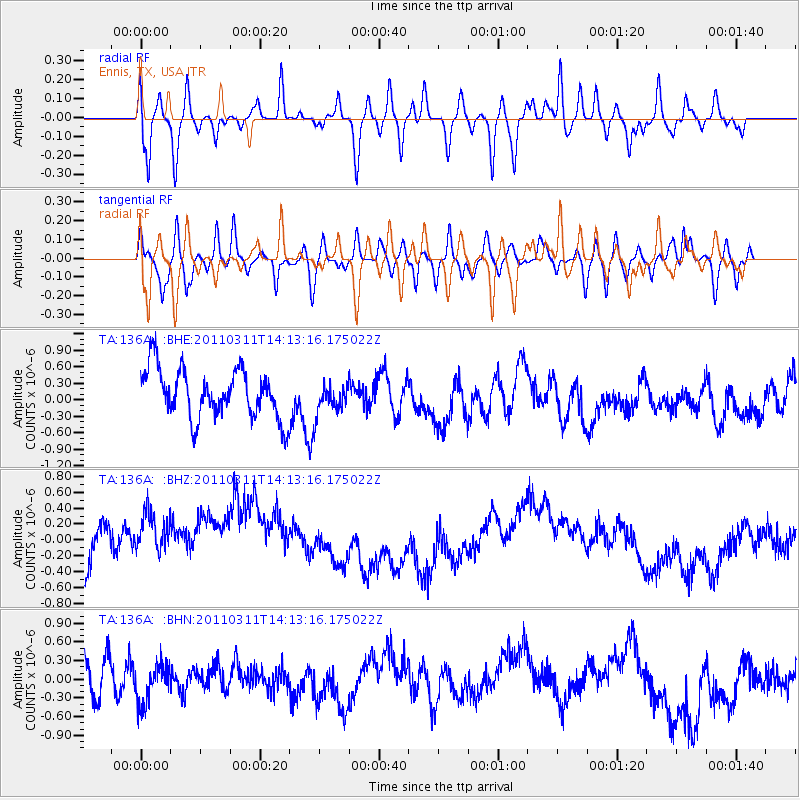
136A Ennis, TX, USA - Earthquake Result Viewer
*The percent match for this event was below the threshold and hence no stack was calculated.
| Earthquake location: |
Near East Coast Of Honshu, Japan |
| Earthquake latitude/longitude: |
36.1/140.8 |
| Earthquake time(UTC): |
2011/03/11 (070) 14:00:38 GMT |
| Earthquake Depth: |
51 km |
| Earthquake Magnitude: |
5.5 MB, 5.4 MS |
| Earthquake Catalog/Contributor: |
WHDF/NEIC |
|
| Network: |
TA USArray Transportable Network (new EarthScope stations) |
| Station: |
136A Ennis, TX, USA |
| Lat/Lon: |
32.47 N/96.53 W |
| Elevation: |
113 m |
|
| Distance: |
93.2 deg |
| Az: |
45.426 deg |
| Baz: |
316.975 deg |
| Ray Param: |
$rayparam |
*The percent match for this event was below the threshold and hence was not used in the summary stack. |
|
| Radial Match: |
63.362263 % |
| Radial Bump: |
400 |
| Transverse Match: |
46.775883 % |
| Transverse Bump: |
400 |
| SOD ConfigId: |
356183 |
| Insert Time: |
2011-08-16 20:08:43.170 +0000 |
| GWidth: |
2.5 |
| Max Bumps: |
400 |
| Tol: |
0.001 |
|
Signal To Noise
| Channel | StoN | STA | LTA |
| TA:136A: :BHZ:20110311T14:13:16.175022Z | 1.0795257 | 7.026023E-7 | 6.508435E-7 |
| TA:136A: :BHN:20110311T14:13:16.175022Z | 0.8232606 | 2.9345196E-7 | 3.5645087E-7 |
| TA:136A: :BHE:20110311T14:13:16.175022Z | 0.6251318 | 2.7795704E-7 | 4.4463755E-7 |
| Arrivals |
| Ps | |
| PpPs | |
| PsPs/PpSs | |


