You are here: Home > Network List > TA - USArray Transportable Network (new EarthScope stations) Stations List
> Station E62A Clayton Lake, ME, USA > Earthquake Result Viewer
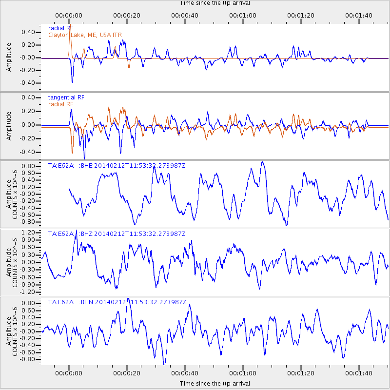
E62A Clayton Lake, ME, USA - Earthquake Result Viewer
*The percent match for this event was below the threshold and hence no stack was calculated.
| Earthquake location: |
Northern Chile |
| Earthquake latitude/longitude: |
-22.4/-68.8 |
| Earthquake time(UTC): |
2014/02/12 (043) 11:43:10 GMT |
| Earthquake Depth: |
100 km |
| Earthquake Magnitude: |
5.6 MWW, 5.6 MWR |
| Earthquake Catalog/Contributor: |
NEIC PDE/NEIC COMCAT |
|
| Network: |
TA USArray Transportable Network (new EarthScope stations) |
| Station: |
E62A Clayton Lake, ME, USA |
| Lat/Lon: |
46.62 N/69.52 W |
| Elevation: |
356 m |
|
| Distance: |
68.6 deg |
| Az: |
359.475 deg |
| Baz: |
179.295 deg |
| Ray Param: |
$rayparam |
*The percent match for this event was below the threshold and hence was not used in the summary stack. |
|
| Radial Match: |
60.54544 % |
| Radial Bump: |
400 |
| Transverse Match: |
78.060814 % |
| Transverse Bump: |
400 |
| SOD ConfigId: |
3390531 |
| Insert Time: |
2019-04-10 08:09:58.346 +0000 |
| GWidth: |
2.5 |
| Max Bumps: |
400 |
| Tol: |
0.001 |
|
Signal To Noise
| Channel | StoN | STA | LTA |
| TA:E62A: :BHZ:20140212T11:53:32.273987Z | 1.505102 | 6.0204894E-7 | 4.0000538E-7 |
| TA:E62A: :BHN:20140212T11:53:32.273987Z | 1.3139008 | 2.4706753E-7 | 1.8804124E-7 |
| TA:E62A: :BHE:20140212T11:53:32.273987Z | 1.2800052 | 5.42766E-7 | 4.240342E-7 |
| Arrivals |
| Ps | |
| PpPs | |
| PsPs/PpSs | |


