You are here: Home > Network List > TA - USArray Transportable Network (new EarthScope stations) Stations List
> Station H31A Wolsey, SD, USA > Earthquake Result Viewer
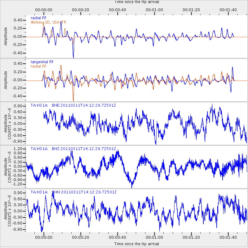
H31A Wolsey, SD, USA - Earthquake Result Viewer
*The percent match for this event was below the threshold and hence no stack was calculated.
| Earthquake location: |
Near East Coast Of Honshu, Japan |
| Earthquake latitude/longitude: |
36.1/140.8 |
| Earthquake time(UTC): |
2011/03/11 (070) 14:00:38 GMT |
| Earthquake Depth: |
51 km |
| Earthquake Magnitude: |
5.5 MB, 5.4 MS |
| Earthquake Catalog/Contributor: |
WHDF/NEIC |
|
| Network: |
TA USArray Transportable Network (new EarthScope stations) |
| Station: |
H31A Wolsey, SD, USA |
| Lat/Lon: |
44.48 N/98.48 W |
| Elevation: |
415 m |
|
| Distance: |
83.5 deg |
| Az: |
38.252 deg |
| Baz: |
315.554 deg |
| Ray Param: |
$rayparam |
*The percent match for this event was below the threshold and hence was not used in the summary stack. |
|
| Radial Match: |
68.96978 % |
| Radial Bump: |
400 |
| Transverse Match: |
51.891476 % |
| Transverse Bump: |
400 |
| SOD ConfigId: |
356183 |
| Insert Time: |
2011-08-16 20:16:47.756 +0000 |
| GWidth: |
2.5 |
| Max Bumps: |
400 |
| Tol: |
0.001 |
|
Signal To Noise
| Channel | StoN | STA | LTA |
| TA:H31A: :BHZ:20110311T14:12:29.72501Z | 1.5887728 | 7.1833307E-7 | 4.5213076E-7 |
| TA:H31A: :BHN:20110311T14:12:29.72501Z | 1.4477584 | 5.277101E-7 | 3.645015E-7 |
| TA:H31A: :BHE:20110311T14:12:29.72501Z | 0.71951795 | 2.2386531E-7 | 3.1113234E-7 |
| Arrivals |
| Ps | |
| PpPs | |
| PsPs/PpSs | |


