You are here: Home > Network List > US - United States National Seismic Network Stations List
> Station MIAR Mount Ida, Arkansas, USA > Earthquake Result Viewer
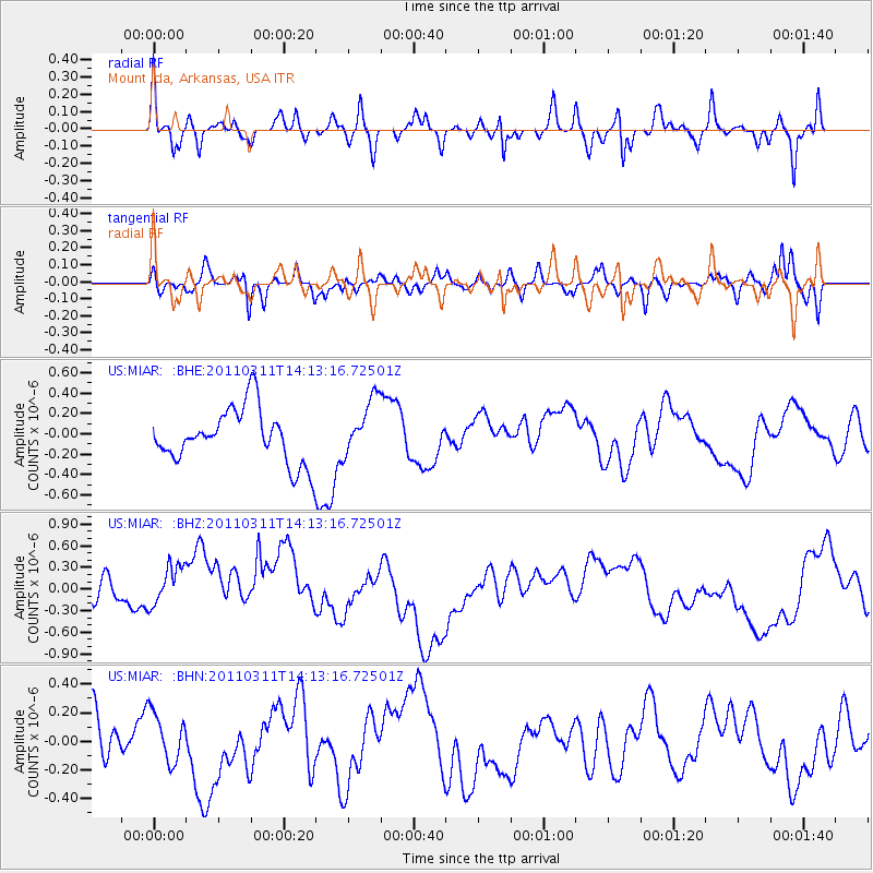
MIAR Mount Ida, Arkansas, USA - Earthquake Result Viewer
*The percent match for this event was below the threshold and hence no stack was calculated.
| Earthquake location: |
Near East Coast Of Honshu, Japan |
| Earthquake latitude/longitude: |
36.1/140.8 |
| Earthquake time(UTC): |
2011/03/11 (070) 14:00:38 GMT |
| Earthquake Depth: |
51 km |
| Earthquake Magnitude: |
5.5 MB, 5.4 MS |
| Earthquake Catalog/Contributor: |
WHDF/NEIC |
|
| Network: |
US United States National Seismic Network |
| Station: |
MIAR Mount Ida, Arkansas, USA |
| Lat/Lon: |
34.55 N/93.58 W |
| Elevation: |
207 m |
|
| Distance: |
93.3 deg |
| Az: |
42.206 deg |
| Baz: |
318.782 deg |
| Ray Param: |
$rayparam |
*The percent match for this event was below the threshold and hence was not used in the summary stack. |
|
| Radial Match: |
59.226013 % |
| Radial Bump: |
400 |
| Transverse Match: |
64.37536 % |
| Transverse Bump: |
400 |
| SOD ConfigId: |
356183 |
| Insert Time: |
2011-08-16 20:34:20.123 +0000 |
| GWidth: |
2.5 |
| Max Bumps: |
400 |
| Tol: |
0.001 |
|
Signal To Noise
| Channel | StoN | STA | LTA |
| US:MIAR: :BHZ:20110311T14:13:16.72501Z | 1.342111 | 5.560474E-7 | 4.1430806E-7 |
| US:MIAR: :BHN:20110311T14:13:16.72501Z | 0.9028406 | 1.7139878E-7 | 1.898439E-7 |
| US:MIAR: :BHE:20110311T14:13:16.72501Z | 1.0553389 | 2.811616E-7 | 2.6641828E-7 |
| Arrivals |
| Ps | |
| PpPs | |
| PsPs/PpSs | |


