You are here: Home > Network List > US - United States National Seismic Network Stations List
> Station DGMT Dagmar, Montana, USA > Earthquake Result Viewer
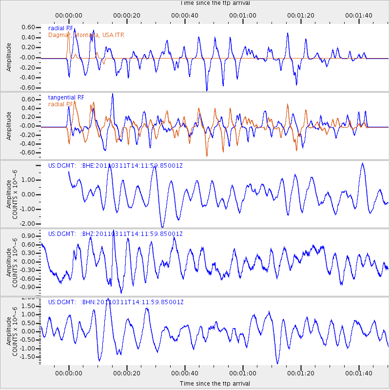
DGMT Dagmar, Montana, USA - Earthquake Result Viewer
*The percent match for this event was below the threshold and hence no stack was calculated.
| Earthquake location: |
Near East Coast Of Honshu, Japan |
| Earthquake latitude/longitude: |
36.1/140.8 |
| Earthquake time(UTC): |
2011/03/11 (070) 14:00:38 GMT |
| Earthquake Depth: |
51 km |
| Earthquake Magnitude: |
5.5 MB, 5.4 MS |
| Earthquake Catalog/Contributor: |
WHDF/NEIC |
|
| Network: |
US United States National Seismic Network |
| Station: |
DGMT Dagmar, Montana, USA |
| Lat/Lon: |
48.47 N/104.20 W |
| Elevation: |
0.0 m |
|
| Distance: |
77.9 deg |
| Az: |
38.075 deg |
| Baz: |
311.388 deg |
| Ray Param: |
$rayparam |
*The percent match for this event was below the threshold and hence was not used in the summary stack. |
|
| Radial Match: |
50.358868 % |
| Radial Bump: |
354 |
| Transverse Match: |
59.820965 % |
| Transverse Bump: |
354 |
| SOD ConfigId: |
356183 |
| Insert Time: |
2011-08-16 20:40:46.920 +0000 |
| GWidth: |
2.5 |
| Max Bumps: |
400 |
| Tol: |
0.001 |
|
Signal To Noise
| Channel | StoN | STA | LTA |
| US:DGMT: :BHZ:20110311T14:11:59.85001Z | 1.050339 | 5.007858E-7 | 4.7678495E-7 |
| US:DGMT: :BHN:20110311T14:11:59.85001Z | 1.060301 | 7.658276E-7 | 7.222738E-7 |
| US:DGMT: :BHE:20110311T14:11:59.85001Z | 2.0460541 | 1.5162248E-6 | 7.410482E-7 |
| Arrivals |
| Ps | |
| PpPs | |
| PsPs/PpSs | |


