
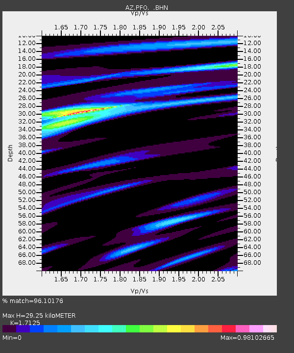
PFO AZ.PFO - Earthquake Result Viewer
| ||||||||||||||||||
| ||||||||||||||||||
| ||||||||||||||||||
|
Signal To Noise
| Channel | StoN | STA | LTA |
| AZ:PFO: :BHN:20050816T02:57:51.725012Z | 2.7209482 | 3.3298815E-7 | 1.2237945E-7 |
| AZ:PFO: :BHE:20050816T02:57:51.725012Z | 0.8699367 | 1.2829987E-7 | 1.4748186E-7 |
| AZ:PFO: :BHZ:20050816T02:57:51.725012Z | 4.8047094 | 6.649949E-7 | 1.384048E-7 |
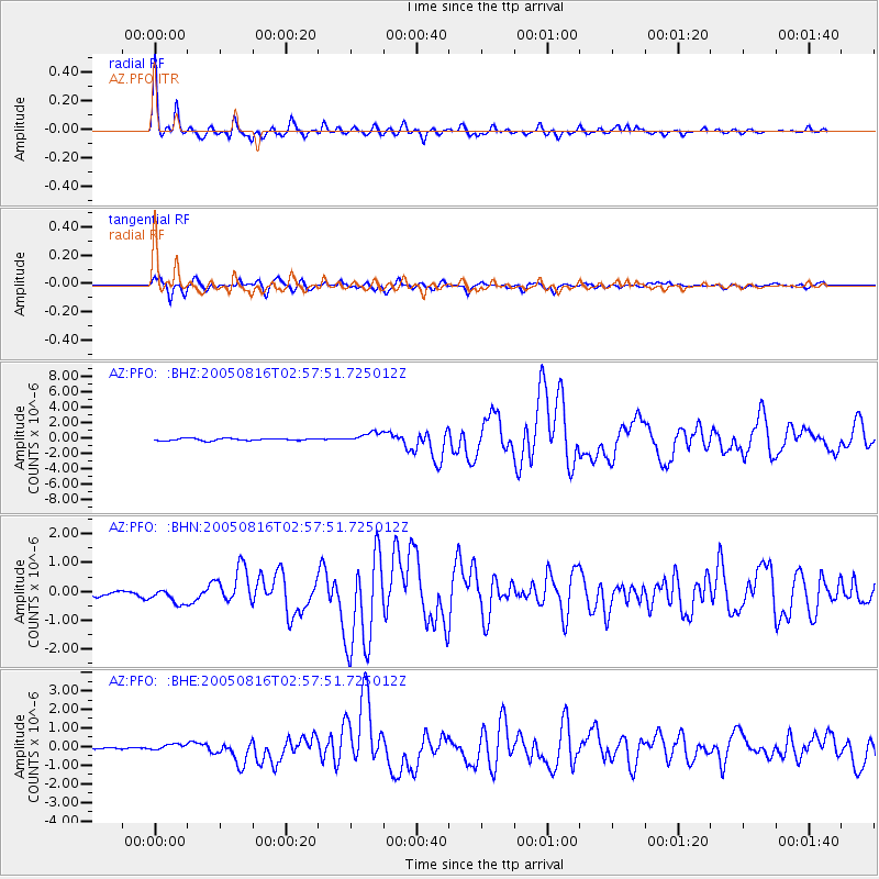
| Arrivals | |
| Ps | 3.4 SECOND |
| PpPs | 12 SECOND |
| PsPs/PpSs | 16 SECOND |

