You are here: Home > Network List > TA - USArray Transportable Network (new EarthScope stations) Stations List
> Station Y12C Blythe, CA, USA > Earthquake Result Viewer
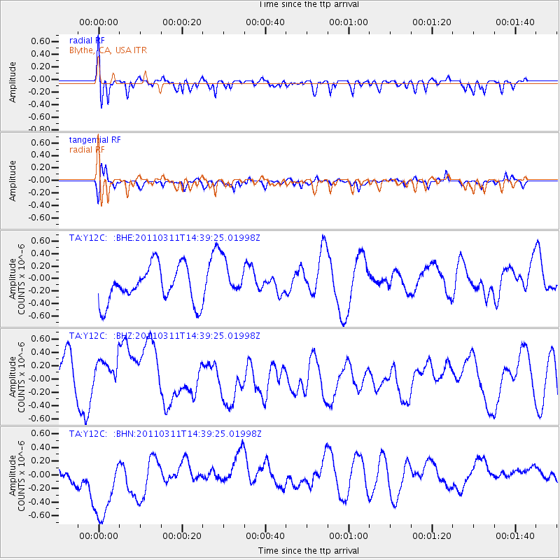
Y12C Blythe, CA, USA - Earthquake Result Viewer
*The percent match for this event was below the threshold and hence no stack was calculated.
| Earthquake location: |
Off East Coast Of Honshu, Japan |
| Earthquake latitude/longitude: |
37.1/144.0 |
| Earthquake time(UTC): |
2011/03/11 (070) 14:27:57 GMT |
| Earthquake Depth: |
21 km |
| Earthquake Magnitude: |
5.5 MB |
| Earthquake Catalog/Contributor: |
WHDF/NEIC |
|
| Network: |
TA USArray Transportable Network (new EarthScope stations) |
| Station: |
Y12C Blythe, CA, USA |
| Lat/Lon: |
33.75 N/114.52 W |
| Elevation: |
196 m |
|
| Distance: |
78.5 deg |
| Az: |
56.459 deg |
| Baz: |
306.899 deg |
| Ray Param: |
$rayparam |
*The percent match for this event was below the threshold and hence was not used in the summary stack. |
|
| Radial Match: |
52.98241 % |
| Radial Bump: |
400 |
| Transverse Match: |
45.36822 % |
| Transverse Bump: |
354 |
| SOD ConfigId: |
356183 |
| Insert Time: |
2011-08-16 21:51:59.786 +0000 |
| GWidth: |
2.5 |
| Max Bumps: |
400 |
| Tol: |
0.001 |
|
Signal To Noise
| Channel | StoN | STA | LTA |
| TA:Y12C: :BHZ:20110311T14:39:25.01998Z | 0.92727965 | 3.41963E-7 | 3.6878086E-7 |
| TA:Y12C: :BHN:20110311T14:39:25.01998Z | 1.5526733 | 7.235232E-7 | 4.6598547E-7 |
| TA:Y12C: :BHE:20110311T14:39:25.01998Z | 1.0430291 | 3.006E-7 | 2.881991E-7 |
| Arrivals |
| Ps | |
| PpPs | |
| PsPs/PpSs | |


