You are here: Home > Network List > TA - USArray Transportable Network (new EarthScope stations) Stations List
> Station I25A Rochford, SD, USA > Earthquake Result Viewer
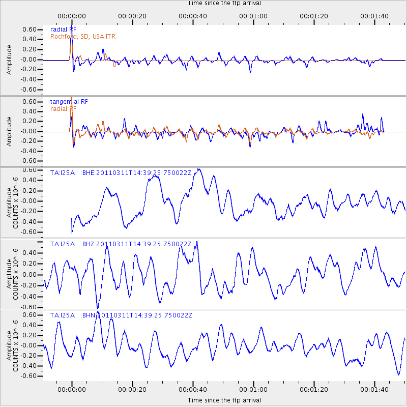
I25A Rochford, SD, USA - Earthquake Result Viewer
*The percent match for this event was below the threshold and hence no stack was calculated.
| Earthquake location: |
Off East Coast Of Honshu, Japan |
| Earthquake latitude/longitude: |
37.1/144.0 |
| Earthquake time(UTC): |
2011/03/11 (070) 14:27:57 GMT |
| Earthquake Depth: |
21 km |
| Earthquake Magnitude: |
5.5 MB |
| Earthquake Catalog/Contributor: |
WHDF/NEIC |
|
| Network: |
TA USArray Transportable Network (new EarthScope stations) |
| Station: |
I25A Rochford, SD, USA |
| Lat/Lon: |
44.02 N/103.73 W |
| Elevation: |
1856 m |
|
| Distance: |
78.6 deg |
| Az: |
42.943 deg |
| Baz: |
310.984 deg |
| Ray Param: |
$rayparam |
*The percent match for this event was below the threshold and hence was not used in the summary stack. |
|
| Radial Match: |
58.097782 % |
| Radial Bump: |
370 |
| Transverse Match: |
79.40803 % |
| Transverse Bump: |
400 |
| SOD ConfigId: |
356183 |
| Insert Time: |
2011-08-16 22:00:05.796 +0000 |
| GWidth: |
2.5 |
| Max Bumps: |
400 |
| Tol: |
0.001 |
|
Signal To Noise
| Channel | StoN | STA | LTA |
| TA:I25A: :BHZ:20110311T14:39:25.750022Z | 0.6813263 | 1.6482068E-7 | 2.419115E-7 |
| TA:I25A: :BHN:20110311T14:39:25.750022Z | 0.96771836 | 2.0400422E-7 | 2.1080949E-7 |
| TA:I25A: :BHE:20110311T14:39:25.750022Z | 1.1794393 | 2.77845E-7 | 2.3557381E-7 |
| Arrivals |
| Ps | |
| PpPs | |
| PsPs/PpSs | |


