You are here: Home > Network List > TA - USArray Transportable Network (new EarthScope stations) Stations List
> Station S33A Kaszmaul Farm, Murdock, KS, USA > Earthquake Result Viewer
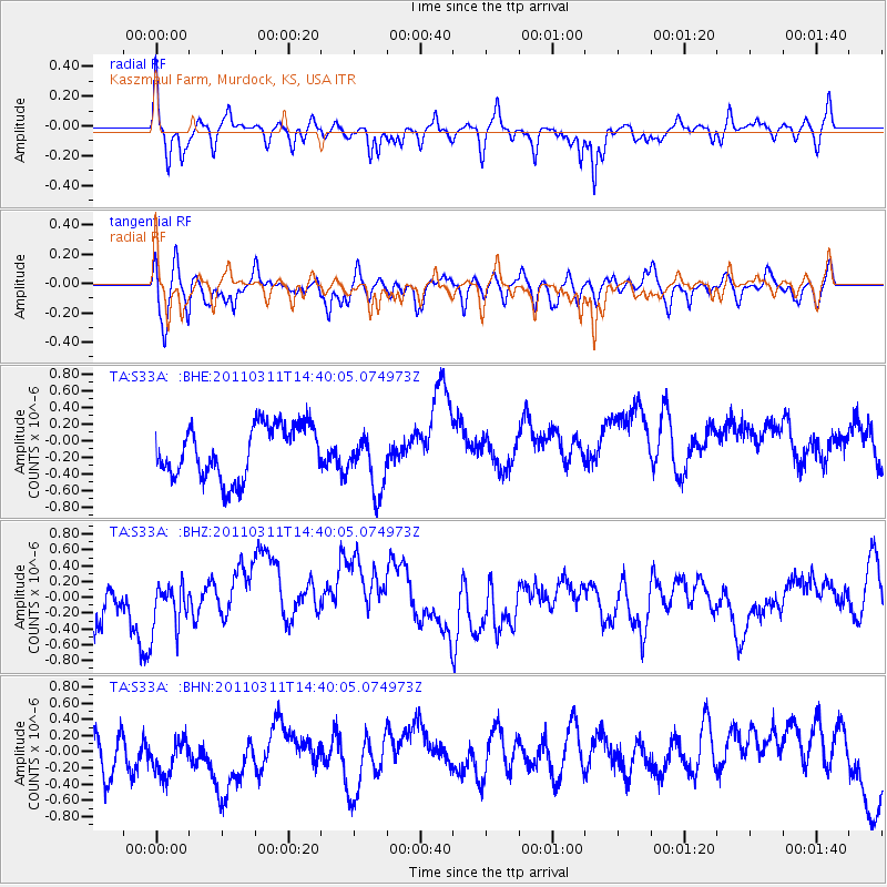
S33A Kaszmaul Farm, Murdock, KS, USA - Earthquake Result Viewer
*The percent match for this event was below the threshold and hence no stack was calculated.
| Earthquake location: |
Off East Coast Of Honshu, Japan |
| Earthquake latitude/longitude: |
37.1/144.0 |
| Earthquake time(UTC): |
2011/03/11 (070) 14:27:57 GMT |
| Earthquake Depth: |
21 km |
| Earthquake Magnitude: |
5.5 MB |
| Earthquake Catalog/Contributor: |
WHDF/NEIC |
|
| Network: |
TA USArray Transportable Network (new EarthScope stations) |
| Station: |
S33A Kaszmaul Farm, Murdock, KS, USA |
| Lat/Lon: |
37.59 N/98.00 W |
| Elevation: |
471 m |
|
| Distance: |
86.1 deg |
| Az: |
44.683 deg |
| Baz: |
314.954 deg |
| Ray Param: |
$rayparam |
*The percent match for this event was below the threshold and hence was not used in the summary stack. |
|
| Radial Match: |
56.1235 % |
| Radial Bump: |
299 |
| Transverse Match: |
49.08256 % |
| Transverse Bump: |
400 |
| SOD ConfigId: |
356183 |
| Insert Time: |
2011-08-16 22:10:33.822 +0000 |
| GWidth: |
2.5 |
| Max Bumps: |
400 |
| Tol: |
0.001 |
|
Signal To Noise
| Channel | StoN | STA | LTA |
| TA:S33A: :BHZ:20110311T14:40:05.074973Z | 0.7967565 | 2.6629812E-7 | 3.3422776E-7 |
| TA:S33A: :BHN:20110311T14:40:05.074973Z | 1.011642 | 4.0577214E-7 | 4.011025E-7 |
| TA:S33A: :BHE:20110311T14:40:05.074973Z | 1.1115955 | 3.5105458E-7 | 3.1581143E-7 |
| Arrivals |
| Ps | |
| PpPs | |
| PsPs/PpSs | |


