You are here: Home > Network List > TA - USArray Transportable Network (new EarthScope stations) Stations List
> Station L02D Cave Junction, OR, USA > Earthquake Result Viewer
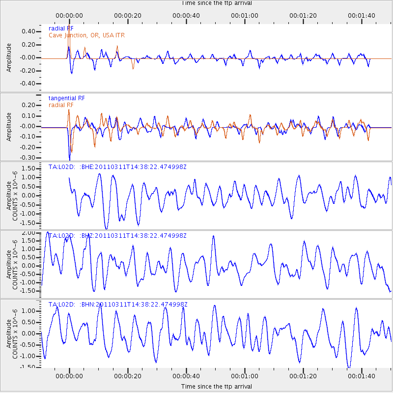
L02D Cave Junction, OR, USA - Earthquake Result Viewer
*The percent match for this event was below the threshold and hence no stack was calculated.
| Earthquake location: |
Off East Coast Of Honshu, Japan |
| Earthquake latitude/longitude: |
37.1/144.0 |
| Earthquake time(UTC): |
2011/03/11 (070) 14:27:57 GMT |
| Earthquake Depth: |
21 km |
| Earthquake Magnitude: |
5.5 MB |
| Earthquake Catalog/Contributor: |
WHDF/NEIC |
|
| Network: |
TA USArray Transportable Network (new EarthScope stations) |
| Station: |
L02D Cave Junction, OR, USA |
| Lat/Lon: |
42.16 N/123.60 W |
| Elevation: |
458 m |
|
| Distance: |
67.8 deg |
| Az: |
53.339 deg |
| Baz: |
300.407 deg |
| Ray Param: |
$rayparam |
*The percent match for this event was below the threshold and hence was not used in the summary stack. |
|
| Radial Match: |
41.288982 % |
| Radial Bump: |
380 |
| Transverse Match: |
46.35864 % |
| Transverse Bump: |
363 |
| SOD ConfigId: |
356183 |
| Insert Time: |
2011-08-16 22:13:33.966 +0000 |
| GWidth: |
2.5 |
| Max Bumps: |
400 |
| Tol: |
0.001 |
|
Signal To Noise
| Channel | StoN | STA | LTA |
| TA:L02D: :BHZ:20110311T14:38:22.474998Z | 0.9578505 | 2.2599932E-6 | 2.3594423E-6 |
| TA:L02D: :BHN:20110311T14:38:22.474998Z | 0.81615996 | 8.7671197E-7 | 1.0741913E-6 |
| TA:L02D: :BHE:20110311T14:38:22.474998Z | 0.5519761 | 4.4547915E-7 | 8.070624E-7 |
| Arrivals |
| Ps | |
| PpPs | |
| PsPs/PpSs | |


