You are here: Home > Network List > TA - USArray Transportable Network (new EarthScope stations) Stations List
> Station X36A Centrahoma, OK, USA > Earthquake Result Viewer
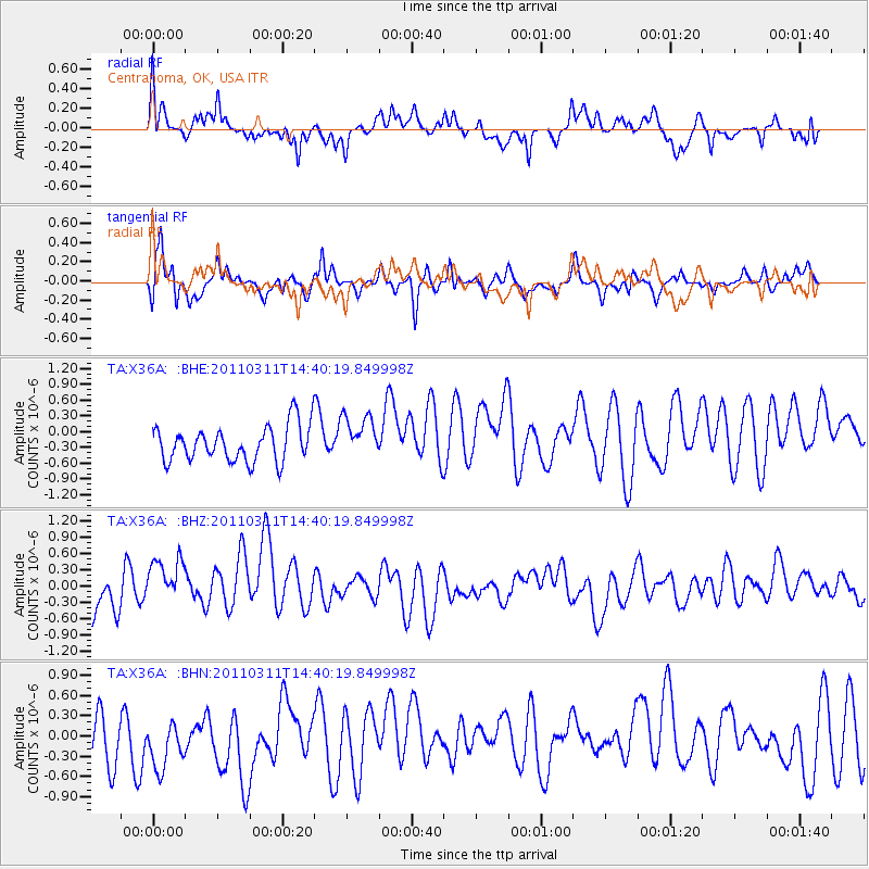
X36A Centrahoma, OK, USA - Earthquake Result Viewer
*The percent match for this event was below the threshold and hence no stack was calculated.
| Earthquake location: |
Off East Coast Of Honshu, Japan |
| Earthquake latitude/longitude: |
37.1/144.0 |
| Earthquake time(UTC): |
2011/03/11 (070) 14:27:57 GMT |
| Earthquake Depth: |
21 km |
| Earthquake Magnitude: |
5.5 MB |
| Earthquake Catalog/Contributor: |
WHDF/NEIC |
|
| Network: |
TA USArray Transportable Network (new EarthScope stations) |
| Station: |
X36A Centrahoma, OK, USA |
| Lat/Lon: |
34.57 N/96.35 W |
| Elevation: |
211 m |
|
| Distance: |
89.2 deg |
| Az: |
45.848 deg |
| Baz: |
315.968 deg |
| Ray Param: |
$rayparam |
*The percent match for this event was below the threshold and hence was not used in the summary stack. |
|
| Radial Match: |
58.745384 % |
| Radial Bump: |
400 |
| Transverse Match: |
59.28957 % |
| Transverse Bump: |
400 |
| SOD ConfigId: |
356183 |
| Insert Time: |
2011-08-16 22:23:43.865 +0000 |
| GWidth: |
2.5 |
| Max Bumps: |
400 |
| Tol: |
0.001 |
|
Signal To Noise
| Channel | StoN | STA | LTA |
| TA:X36A: :BHZ:20110311T14:40:19.849998Z | 2.211265 | 5.870482E-7 | 2.654807E-7 |
| TA:X36A: :BHN:20110311T14:40:19.849998Z | 1.2609435 | 6.2155095E-7 | 4.9292527E-7 |
| TA:X36A: :BHE:20110311T14:40:19.849998Z | 1.2035196 | 4.1333232E-7 | 3.434363E-7 |
| Arrivals |
| Ps | |
| PpPs | |
| PsPs/PpSs | |


