You are here: Home > Network List > TA - USArray Transportable Network (new EarthScope stations) Stations List
> Station T37A Cheneyville 1850, Columbus, KS, USA > Earthquake Result Viewer
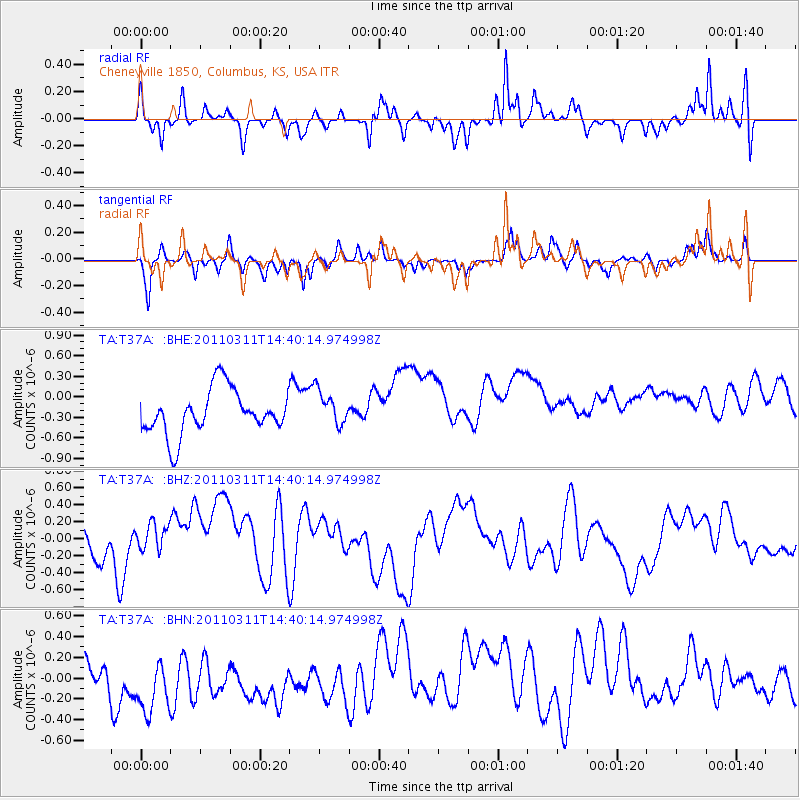
T37A Cheneyville 1850, Columbus, KS, USA - Earthquake Result Viewer
*The percent match for this event was below the threshold and hence no stack was calculated.
| Earthquake location: |
Off East Coast Of Honshu, Japan |
| Earthquake latitude/longitude: |
37.1/144.0 |
| Earthquake time(UTC): |
2011/03/11 (070) 14:27:57 GMT |
| Earthquake Depth: |
21 km |
| Earthquake Magnitude: |
5.5 MB |
| Earthquake Catalog/Contributor: |
WHDF/NEIC |
|
| Network: |
TA USArray Transportable Network (new EarthScope stations) |
| Station: |
T37A Cheneyville 1850, Columbus, KS, USA |
| Lat/Lon: |
37.12 N/94.92 W |
| Elevation: |
256 m |
|
| Distance: |
88.2 deg |
| Az: |
43.246 deg |
| Baz: |
316.746 deg |
| Ray Param: |
$rayparam |
*The percent match for this event was below the threshold and hence was not used in the summary stack. |
|
| Radial Match: |
44.87544 % |
| Radial Bump: |
298 |
| Transverse Match: |
53.750072 % |
| Transverse Bump: |
246 |
| SOD ConfigId: |
356183 |
| Insert Time: |
2011-08-16 22:27:50.155 +0000 |
| GWidth: |
2.5 |
| Max Bumps: |
400 |
| Tol: |
0.001 |
|
Signal To Noise
| Channel | StoN | STA | LTA |
| TA:T37A: :BHZ:20110311T14:40:14.974998Z | 0.70812637 | 2.6308604E-7 | 3.7152412E-7 |
| TA:T37A: :BHN:20110311T14:40:14.974998Z | 0.8613889 | 6.2012543E-7 | 7.199134E-7 |
| TA:T37A: :BHE:20110311T14:40:14.974998Z | 0.7731174 | 2.5153736E-7 | 3.2535468E-7 |
| Arrivals |
| Ps | |
| PpPs | |
| PsPs/PpSs | |


