You are here: Home > Network List > TA - USArray Transportable Network (new EarthScope stations) Stations List
> Station T40A Mansfield, MO, USA > Earthquake Result Viewer
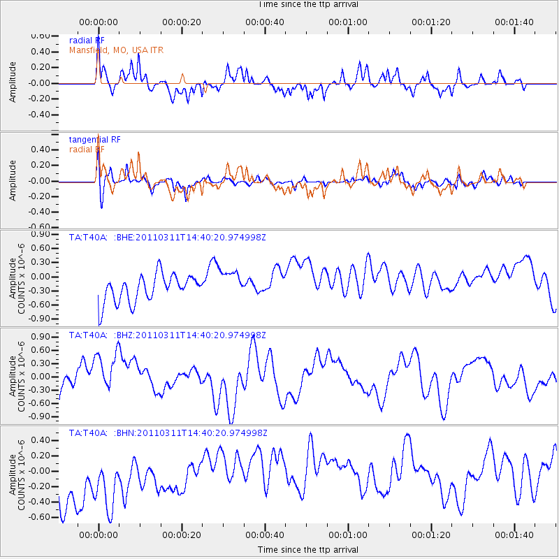
T40A Mansfield, MO, USA - Earthquake Result Viewer
*The percent match for this event was below the threshold and hence no stack was calculated.
| Earthquake location: |
Off East Coast Of Honshu, Japan |
| Earthquake latitude/longitude: |
37.1/144.0 |
| Earthquake time(UTC): |
2011/03/11 (070) 14:27:57 GMT |
| Earthquake Depth: |
21 km |
| Earthquake Magnitude: |
5.5 MB |
| Earthquake Catalog/Contributor: |
WHDF/NEIC |
|
| Network: |
TA USArray Transportable Network (new EarthScope stations) |
| Station: |
T40A Mansfield, MO, USA |
| Lat/Lon: |
37.15 N/92.52 W |
| Elevation: |
399 m |
|
| Distance: |
89.5 deg |
| Az: |
41.815 deg |
| Baz: |
318.159 deg |
| Ray Param: |
$rayparam |
*The percent match for this event was below the threshold and hence was not used in the summary stack. |
|
| Radial Match: |
63.808254 % |
| Radial Bump: |
400 |
| Transverse Match: |
59.68961 % |
| Transverse Bump: |
400 |
| SOD ConfigId: |
356183 |
| Insert Time: |
2011-08-16 22:51:05.416 +0000 |
| GWidth: |
2.5 |
| Max Bumps: |
400 |
| Tol: |
0.001 |
|
Signal To Noise
| Channel | StoN | STA | LTA |
| TA:T40A: :BHZ:20110311T14:40:20.974998Z | 1.5926484 | 6.614018E-7 | 4.1528426E-7 |
| TA:T40A: :BHN:20110311T14:40:20.974998Z | 1.089936 | 7.47444E-7 | 6.8576867E-7 |
| TA:T40A: :BHE:20110311T14:40:20.974998Z | 1.065549 | 3.0660843E-7 | 2.877469E-7 |
| Arrivals |
| Ps | |
| PpPs | |
| PsPs/PpSs | |


