You are here: Home > Network List > US - United States National Seismic Network Stations List
> Station AMTX Amarillo, Texas, USA > Earthquake Result Viewer
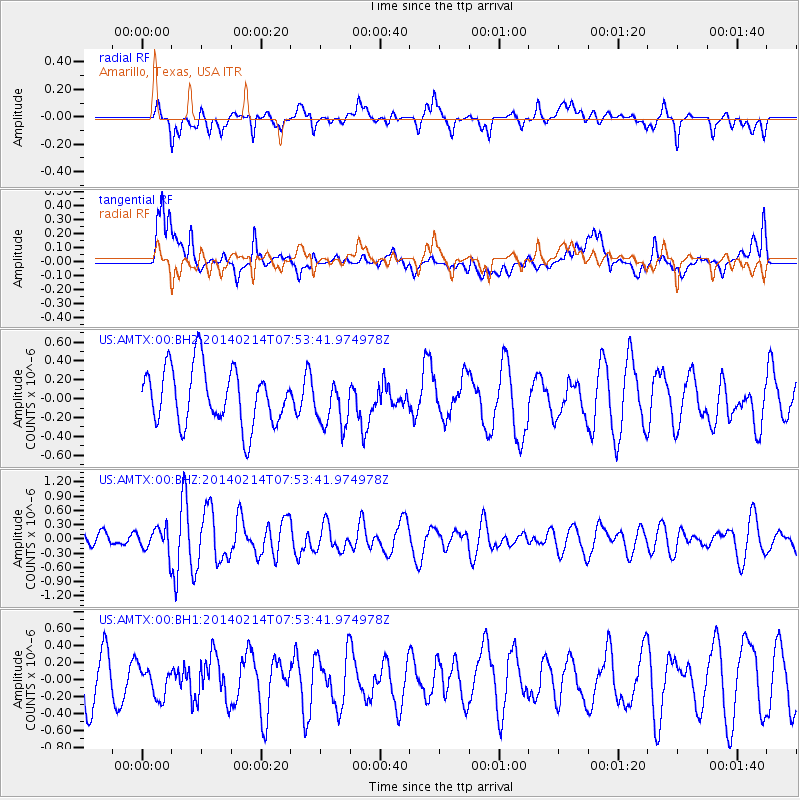
AMTX Amarillo, Texas, USA - Earthquake Result Viewer
*The percent match for this event was below the threshold and hence no stack was calculated.
| Earthquake location: |
Easter Island Region |
| Earthquake latitude/longitude: |
-23.0/-114.3 |
| Earthquake time(UTC): |
2014/02/14 (045) 07:44:15 GMT |
| Earthquake Depth: |
12 km |
| Earthquake Magnitude: |
5.6 MWW, 5.5 MWB, 5.6 MWC |
| Earthquake Catalog/Contributor: |
NEIC PDE/NEIC COMCAT |
|
| Network: |
US United States National Seismic Network |
| Station: |
AMTX Amarillo, Texas, USA |
| Lat/Lon: |
34.53 N/101.41 W |
| Elevation: |
1010 m |
|
| Distance: |
58.5 deg |
| Az: |
12.509 deg |
| Baz: |
193.994 deg |
| Ray Param: |
$rayparam |
*The percent match for this event was below the threshold and hence was not used in the summary stack. |
|
| Radial Match: |
38.632507 % |
| Radial Bump: |
373 |
| Transverse Match: |
54.77045 % |
| Transverse Bump: |
400 |
| SOD ConfigId: |
3390531 |
| Insert Time: |
2019-04-10 08:26:57.363 +0000 |
| GWidth: |
2.5 |
| Max Bumps: |
400 |
| Tol: |
0.001 |
|
Signal To Noise
| Channel | StoN | STA | LTA |
| US:AMTX:00:BHZ:20140214T07:53:41.974978Z | 0.9505013 | 2.70261E-7 | 2.8433524E-7 |
| US:AMTX:00:BH1:20140214T07:53:41.974978Z | 0.5738501 | 1.7765747E-7 | 3.0958864E-7 |
| US:AMTX:00:BH2:20140214T07:53:41.974978Z | 0.74558026 | 2.3310857E-7 | 3.126539E-7 |
| Arrivals |
| Ps | |
| PpPs | |
| PsPs/PpSs | |


