You are here: Home > Network List > UU - University of Utah Regional Network Stations List
> Station KNB Kanab, UT, USA > Earthquake Result Viewer
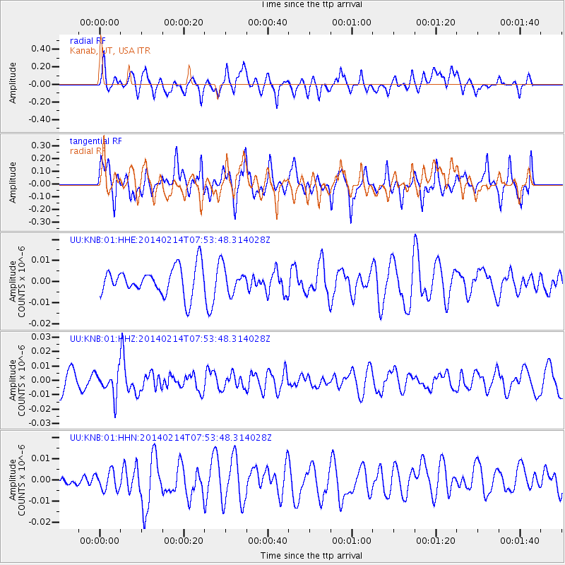
KNB Kanab, UT, USA - Earthquake Result Viewer
*The percent match for this event was below the threshold and hence no stack was calculated.
| Earthquake location: |
Easter Island Region |
| Earthquake latitude/longitude: |
-23.0/-114.3 |
| Earthquake time(UTC): |
2014/02/14 (045) 07:44:15 GMT |
| Earthquake Depth: |
12 km |
| Earthquake Magnitude: |
5.6 MWW, 5.5 MWB, 5.6 MWC |
| Earthquake Catalog/Contributor: |
NEIC PDE/NEIC COMCAT |
|
| Network: |
UU University of Utah Regional Network |
| Station: |
KNB Kanab, UT, USA |
| Lat/Lon: |
37.02 N/112.82 W |
| Elevation: |
1715 m |
|
| Distance: |
59.7 deg |
| Az: |
1.399 deg |
| Baz: |
181.611 deg |
| Ray Param: |
$rayparam |
*The percent match for this event was below the threshold and hence was not used in the summary stack. |
|
| Radial Match: |
44.126602 % |
| Radial Bump: |
400 |
| Transverse Match: |
70.56847 % |
| Transverse Bump: |
400 |
| SOD ConfigId: |
3390531 |
| Insert Time: |
2019-04-10 08:27:08.151 +0000 |
| GWidth: |
2.5 |
| Max Bumps: |
400 |
| Tol: |
0.001 |
|
Signal To Noise
| Channel | StoN | STA | LTA |
| UU:KNB:01:HHZ:20140214T07:53:48.314028Z | 1.5726436 | 8.827071E-9 | 5.612887E-9 |
| UU:KNB:01:HHN:20140214T07:53:48.314028Z | 1.0680048 | 4.984948E-9 | 4.667533E-9 |
| UU:KNB:01:HHE:20140214T07:53:48.314028Z | 0.93693465 | 6.1797656E-9 | 6.5957275E-9 |
| Arrivals |
| Ps | |
| PpPs | |
| PsPs/PpSs | |


