You are here: Home > Network List > CI - Caltech Regional Seismic Network Stations List
> Station MPM Manuel Prospect Mine, California, USA > Earthquake Result Viewer
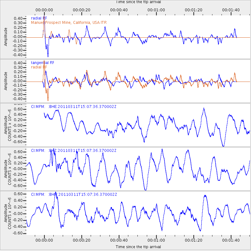
MPM Manuel Prospect Mine, California, USA - Earthquake Result Viewer
*The percent match for this event was below the threshold and hence no stack was calculated.
| Earthquake location: |
Near East Coast Of Honshu, Japan |
| Earthquake latitude/longitude: |
36.0/141.4 |
| Earthquake time(UTC): |
2011/03/11 (070) 14:56:11 GMT |
| Earthquake Depth: |
10 km |
| Earthquake Magnitude: |
5.8 MB |
| Earthquake Catalog/Contributor: |
WHDF/NEIC |
|
| Network: |
CI Caltech Regional Seismic Network |
| Station: |
MPM Manuel Prospect Mine, California, USA |
| Lat/Lon: |
36.06 N/117.49 W |
| Elevation: |
185 m |
|
| Distance: |
77.5 deg |
| Az: |
54.521 deg |
| Baz: |
305.379 deg |
| Ray Param: |
$rayparam |
*The percent match for this event was below the threshold and hence was not used in the summary stack. |
|
| Radial Match: |
53.997105 % |
| Radial Bump: |
352 |
| Transverse Match: |
41.82752 % |
| Transverse Bump: |
400 |
| SOD ConfigId: |
356183 |
| Insert Time: |
2011-08-16 23:38:10.318 +0000 |
| GWidth: |
2.5 |
| Max Bumps: |
400 |
| Tol: |
0.001 |
|
Signal To Noise
| Channel | StoN | STA | LTA |
| CI:MPM: :BHZ:20110311T15:07:36.370002Z | 1.6400506 | 4.6715618E-7 | 2.8484254E-7 |
| CI:MPM: :BHN:20110311T15:07:36.370002Z | 1.1582583 | 3.0471287E-7 | 2.630785E-7 |
| CI:MPM: :BHE:20110311T15:07:36.370002Z | 1.339442 | 3.461587E-7 | 2.5843502E-7 |
| Arrivals |
| Ps | |
| PpPs | |
| PsPs/PpSs | |


