You are here: Home > Network List > TA - USArray Transportable Network (new EarthScope stations) Stations List
> Station S29A Ulysses, KS, USA > Earthquake Result Viewer
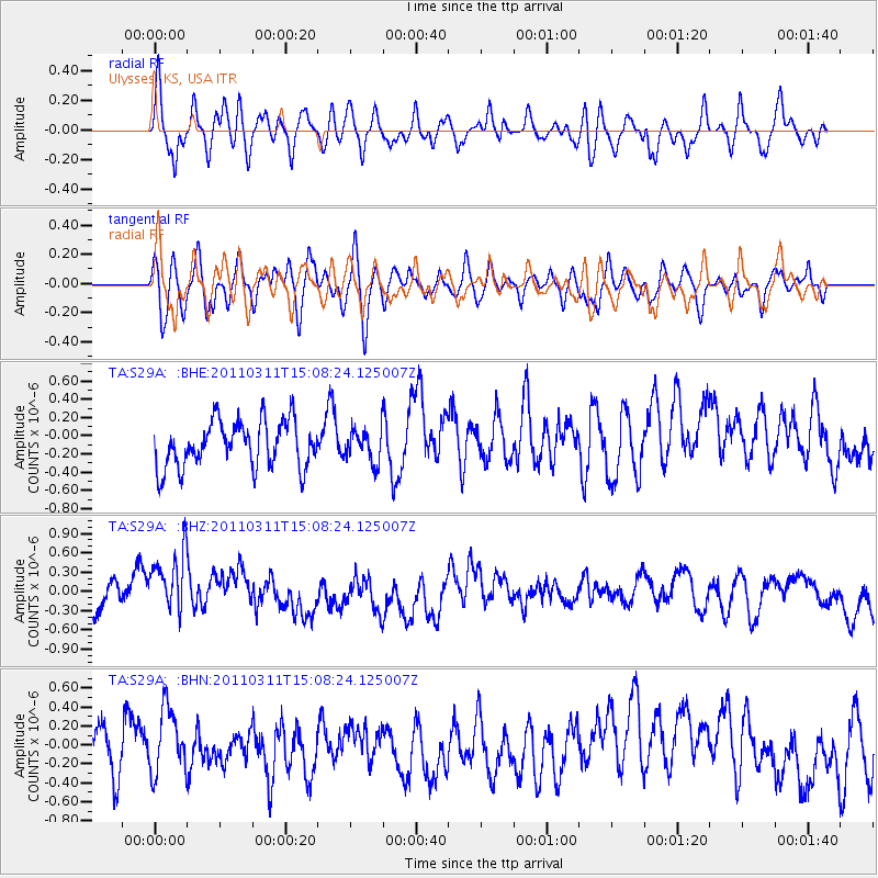
S29A Ulysses, KS, USA - Earthquake Result Viewer
*The percent match for this event was below the threshold and hence no stack was calculated.
| Earthquake location: |
Near East Coast Of Honshu, Japan |
| Earthquake latitude/longitude: |
36.0/141.4 |
| Earthquake time(UTC): |
2011/03/11 (070) 14:56:11 GMT |
| Earthquake Depth: |
10 km |
| Earthquake Magnitude: |
5.8 MB |
| Earthquake Catalog/Contributor: |
WHDF/NEIC |
|
| Network: |
TA USArray Transportable Network (new EarthScope stations) |
| Station: |
S29A Ulysses, KS, USA |
| Lat/Lon: |
37.62 N/101.12 W |
| Elevation: |
931 m |
|
| Distance: |
86.7 deg |
| Az: |
44.883 deg |
| Baz: |
313.864 deg |
| Ray Param: |
$rayparam |
*The percent match for this event was below the threshold and hence was not used in the summary stack. |
|
| Radial Match: |
57.76576 % |
| Radial Bump: |
400 |
| Transverse Match: |
56.348034 % |
| Transverse Bump: |
400 |
| SOD ConfigId: |
356183 |
| Insert Time: |
2011-08-17 00:15:24.504 +0000 |
| GWidth: |
2.5 |
| Max Bumps: |
400 |
| Tol: |
0.001 |
|
Signal To Noise
| Channel | StoN | STA | LTA |
| TA:S29A: :BHZ:20110311T15:08:24.125007Z | 1.8213735 | 5.881144E-7 | 3.228961E-7 |
| TA:S29A: :BHN:20110311T15:08:24.125007Z | 1.1904716 | 3.368152E-7 | 2.8292584E-7 |
| TA:S29A: :BHE:20110311T15:08:24.125007Z | 0.6973431 | 1.7441971E-7 | 2.5012034E-7 |
| Arrivals |
| Ps | |
| PpPs | |
| PsPs/PpSs | |


