You are here: Home > Network List > II - Global Seismograph Network (GSN - IRIS/IDA) Stations List
> Station TAU Hobart, Tasmania, Australia > Earthquake Result Viewer
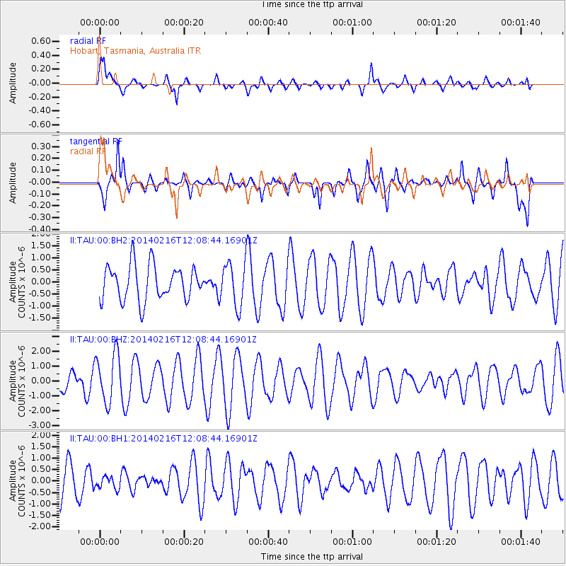
TAU Hobart, Tasmania, Australia - Earthquake Result Viewer
*The percent match for this event was below the threshold and hence no stack was calculated.
| Earthquake location: |
Talaud Islands, Indonesia |
| Earthquake latitude/longitude: |
4.8/126.1 |
| Earthquake time(UTC): |
2014/02/16 (047) 12:00:24 GMT |
| Earthquake Depth: |
134 km |
| Earthquake Magnitude: |
4.9 MW |
| Earthquake Catalog/Contributor: |
ISC/ISC |
|
| Network: |
II Global Seismograph Network (GSN - IRIS/IDA) |
| Station: |
TAU Hobart, Tasmania, Australia |
| Lat/Lon: |
42.91 S/147.32 E |
| Elevation: |
132 m |
|
| Distance: |
51.3 deg |
| Az: |
160.095 deg |
| Baz: |
332.5 deg |
| Ray Param: |
$rayparam |
*The percent match for this event was below the threshold and hence was not used in the summary stack. |
|
| Radial Match: |
66.681145 % |
| Radial Bump: |
400 |
| Transverse Match: |
54.61596 % |
| Transverse Bump: |
400 |
| SOD ConfigId: |
3390531 |
| Insert Time: |
2019-04-10 08:33:43.205 +0000 |
| GWidth: |
2.5 |
| Max Bumps: |
400 |
| Tol: |
0.001 |
|
Signal To Noise
| Channel | StoN | STA | LTA |
| II:TAU:00:BHZ:20140216T12:08:44.16901Z | 1.977843 | 1.6721419E-6 | 8.454371E-7 |
| II:TAU:00:BH1:20140216T12:08:44.16901Z | 0.3512145 | 2.6961132E-7 | 7.676543E-7 |
| II:TAU:00:BH2:20140216T12:08:44.16901Z | 1.2770029 | 9.2511755E-7 | 7.244443E-7 |
| Arrivals |
| Ps | |
| PpPs | |
| PsPs/PpSs | |


