You are here: Home > Network List > TA - USArray Transportable Network (new EarthScope stations) Stations List
> Station R34A Isabella, Hillsboro, KS, USA > Earthquake Result Viewer
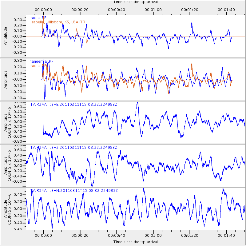
R34A Isabella, Hillsboro, KS, USA - Earthquake Result Viewer
*The percent match for this event was below the threshold and hence no stack was calculated.
| Earthquake location: |
Near East Coast Of Honshu, Japan |
| Earthquake latitude/longitude: |
36.0/141.4 |
| Earthquake time(UTC): |
2011/03/11 (070) 14:56:11 GMT |
| Earthquake Depth: |
10 km |
| Earthquake Magnitude: |
5.8 MB |
| Earthquake Catalog/Contributor: |
WHDF/NEIC |
|
| Network: |
TA USArray Transportable Network (new EarthScope stations) |
| Station: |
R34A Isabella, Hillsboro, KS, USA |
| Lat/Lon: |
38.30 N/97.25 W |
| Elevation: |
437 m |
|
| Distance: |
88.4 deg |
| Az: |
42.237 deg |
| Baz: |
316.121 deg |
| Ray Param: |
$rayparam |
*The percent match for this event was below the threshold and hence was not used in the summary stack. |
|
| Radial Match: |
56.656147 % |
| Radial Bump: |
400 |
| Transverse Match: |
65.08449 % |
| Transverse Bump: |
400 |
| SOD ConfigId: |
356183 |
| Insert Time: |
2011-08-17 00:54:33.911 +0000 |
| GWidth: |
2.5 |
| Max Bumps: |
400 |
| Tol: |
0.001 |
|
Signal To Noise
| Channel | StoN | STA | LTA |
| TA:R34A: :BHZ:20110311T15:08:32.224983Z | 1.0871233 | 3.5722695E-7 | 3.2859836E-7 |
| TA:R34A: :BHN:20110311T15:08:32.224983Z | 1.1440175 | 2.864336E-7 | 2.503752E-7 |
| TA:R34A: :BHE:20110311T15:08:32.224983Z | 1.7607931 | 4.6866495E-7 | 2.6616698E-7 |
| Arrivals |
| Ps | |
| PpPs | |
| PsPs/PpSs | |


