You are here: Home > Network List > PF - Volcanologic Network of Piton de Fournaise-OVPF Stations List
> Station HIM cratere Himiltrude > Earthquake Result Viewer
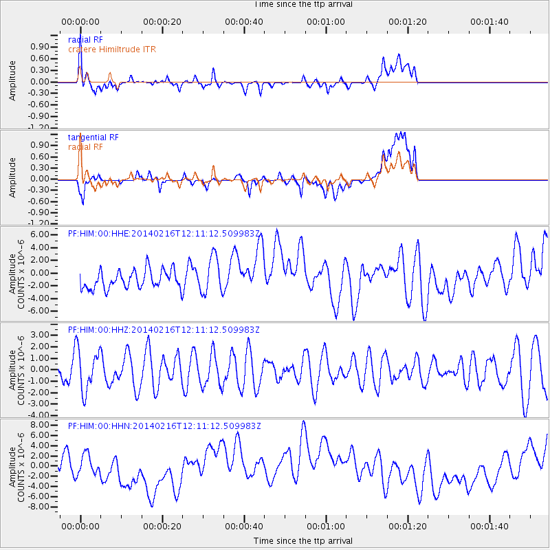
HIM cratere Himiltrude - Earthquake Result Viewer
*The percent match for this event was below the threshold and hence no stack was calculated.
| Earthquake location: |
Talaud Islands, Indonesia |
| Earthquake latitude/longitude: |
4.8/126.1 |
| Earthquake time(UTC): |
2014/02/16 (047) 12:00:24 GMT |
| Earthquake Depth: |
134 km |
| Earthquake Magnitude: |
4.9 MW |
| Earthquake Catalog/Contributor: |
ISC/ISC |
|
| Network: |
PF Volcanologic Network of Piton de Fournaise-OVPF |
| Station: |
HIM cratere Himiltrude |
| Lat/Lon: |
21.21 S/55.72 E |
| Elevation: |
1958 m |
|
| Distance: |
73.6 deg |
| Az: |
246.365 deg |
| Baz: |
78.062 deg |
| Ray Param: |
$rayparam |
*The percent match for this event was below the threshold and hence was not used in the summary stack. |
|
| Radial Match: |
32.068207 % |
| Radial Bump: |
400 |
| Transverse Match: |
25.744942 % |
| Transverse Bump: |
400 |
| SOD ConfigId: |
3390531 |
| Insert Time: |
2019-04-10 08:34:12.989 +0000 |
| GWidth: |
2.5 |
| Max Bumps: |
400 |
| Tol: |
0.001 |
|
Signal To Noise
| Channel | StoN | STA | LTA |
| PF:HIM:00:HHZ:20140216T12:11:12.509983Z | 0.9417195 | 1.8191738E-6 | 1.9317577E-6 |
| PF:HIM:00:HHN:20140216T12:11:12.509983Z | 0.8788613 | 1.9183178E-6 | 2.1827311E-6 |
| PF:HIM:00:HHE:20140216T12:11:12.509983Z | 2.0515444 | 2.9420341E-6 | 1.4340582E-6 |
| Arrivals |
| Ps | |
| PpPs | |
| PsPs/PpSs | |


