You are here: Home > Network List > TA - USArray Transportable Network (new EarthScope stations) Stations List
> Station A32A Rocking H Ranch, Lancaster, MN, USA > Earthquake Result Viewer
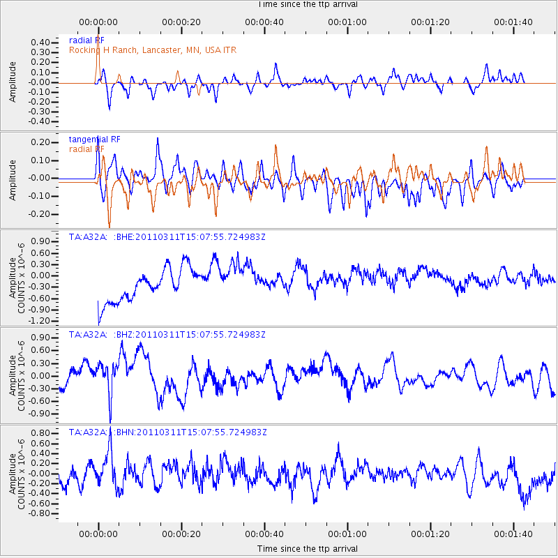
A32A Rocking H Ranch, Lancaster, MN, USA - Earthquake Result Viewer
*The percent match for this event was below the threshold and hence no stack was calculated.
| Earthquake location: |
Near East Coast Of Honshu, Japan |
| Earthquake latitude/longitude: |
36.0/141.4 |
| Earthquake time(UTC): |
2011/03/11 (070) 14:56:11 GMT |
| Earthquake Depth: |
10 km |
| Earthquake Magnitude: |
5.8 MB |
| Earthquake Catalog/Contributor: |
WHDF/NEIC |
|
| Network: |
TA USArray Transportable Network (new EarthScope stations) |
| Station: |
A32A Rocking H Ranch, Lancaster, MN, USA |
| Lat/Lon: |
48.92 N/96.49 W |
| Elevation: |
322 m |
|
| Distance: |
81.1 deg |
| Az: |
34.445 deg |
| Baz: |
315.921 deg |
| Ray Param: |
$rayparam |
*The percent match for this event was below the threshold and hence was not used in the summary stack. |
|
| Radial Match: |
47.7176 % |
| Radial Bump: |
355 |
| Transverse Match: |
38.07042 % |
| Transverse Bump: |
372 |
| SOD ConfigId: |
356183 |
| Insert Time: |
2011-08-17 01:14:38.796 +0000 |
| GWidth: |
2.5 |
| Max Bumps: |
400 |
| Tol: |
0.001 |
|
Signal To Noise
| Channel | StoN | STA | LTA |
| TA:A32A: :BHZ:20110311T15:07:55.724983Z | 1.4426291 | 3.9599527E-7 | 2.7449556E-7 |
| TA:A32A: :BHN:20110311T15:07:55.724983Z | 2.5087862 | 4.0341646E-7 | 1.6080145E-7 |
| TA:A32A: :BHE:20110311T15:07:55.724983Z | 1.1073748 | 4.6426933E-7 | 4.1925222E-7 |
| Arrivals |
| Ps | |
| PpPs | |
| PsPs/PpSs | |


