You are here: Home > Network List > TA - USArray Transportable Network (new EarthScope stations) Stations List
> Station U39A Green Forest, AR, USA > Earthquake Result Viewer
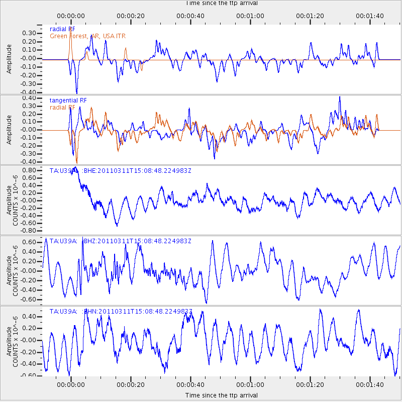
U39A Green Forest, AR, USA - Earthquake Result Viewer
*The percent match for this event was below the threshold and hence no stack was calculated.
| Earthquake location: |
Near East Coast Of Honshu, Japan |
| Earthquake latitude/longitude: |
36.0/141.4 |
| Earthquake time(UTC): |
2011/03/11 (070) 14:56:11 GMT |
| Earthquake Depth: |
10 km |
| Earthquake Magnitude: |
5.8 MB |
| Earthquake Catalog/Contributor: |
WHDF/NEIC |
|
| Network: |
TA USArray Transportable Network (new EarthScope stations) |
| Station: |
U39A Green Forest, AR, USA |
| Lat/Lon: |
36.38 N/93.48 W |
| Elevation: |
433 m |
|
| Distance: |
91.8 deg |
| Az: |
41.332 deg |
| Baz: |
318.398 deg |
| Ray Param: |
$rayparam |
*The percent match for this event was below the threshold and hence was not used in the summary stack. |
|
| Radial Match: |
56.440254 % |
| Radial Bump: |
400 |
| Transverse Match: |
56.63694 % |
| Transverse Bump: |
400 |
| SOD ConfigId: |
356183 |
| Insert Time: |
2011-08-17 01:24:09.736 +0000 |
| GWidth: |
2.5 |
| Max Bumps: |
400 |
| Tol: |
0.001 |
|
Signal To Noise
| Channel | StoN | STA | LTA |
| TA:U39A: :BHZ:20110311T15:08:48.224983Z | 1.3793668 | 3.2558904E-7 | 2.360424E-7 |
| TA:U39A: :BHN:20110311T15:08:48.224983Z | 0.68168414 | 3.9921275E-7 | 5.8562716E-7 |
| TA:U39A: :BHE:20110311T15:08:48.224983Z | 0.46200058 | 1.7601462E-7 | 3.8098358E-7 |
| Arrivals |
| Ps | |
| PpPs | |
| PsPs/PpSs | |


