You are here: Home > Network List > US - United States National Seismic Network Stations List
> Station DGMT Dagmar, Montana, USA > Earthquake Result Viewer
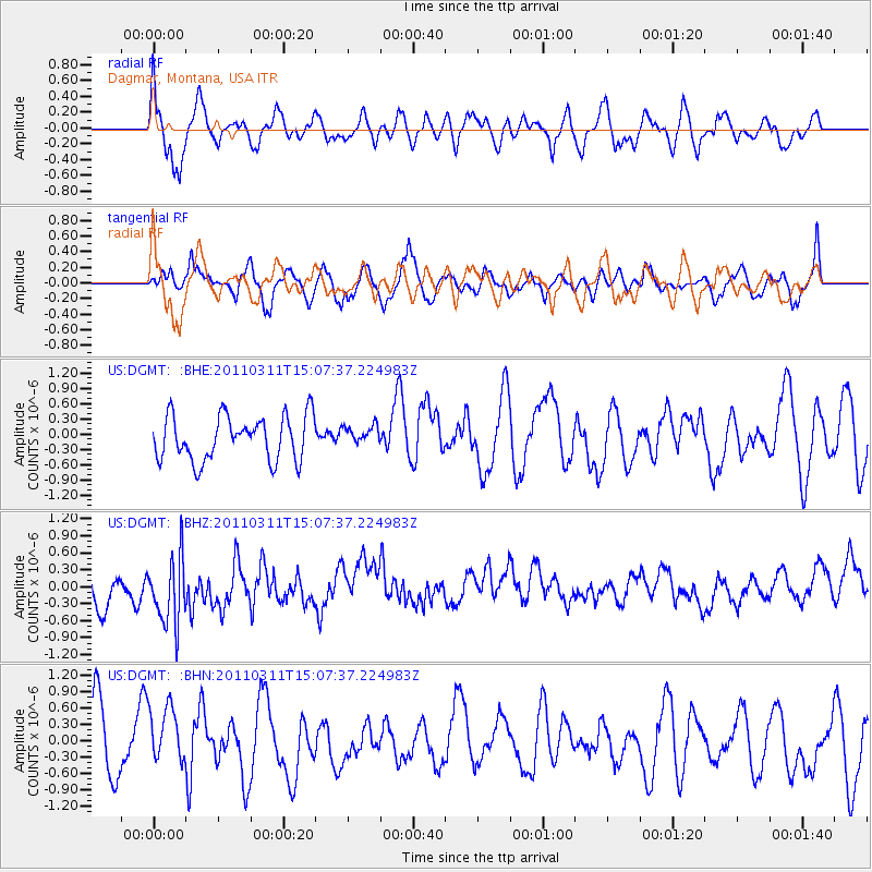
DGMT Dagmar, Montana, USA - Earthquake Result Viewer
*The percent match for this event was below the threshold and hence no stack was calculated.
| Earthquake location: |
Near East Coast Of Honshu, Japan |
| Earthquake latitude/longitude: |
36.0/141.4 |
| Earthquake time(UTC): |
2011/03/11 (070) 14:56:11 GMT |
| Earthquake Depth: |
10 km |
| Earthquake Magnitude: |
5.8 MB |
| Earthquake Catalog/Contributor: |
WHDF/NEIC |
|
| Network: |
US United States National Seismic Network |
| Station: |
DGMT Dagmar, Montana, USA |
| Lat/Lon: |
48.47 N/104.20 W |
| Elevation: |
0.0 m |
|
| Distance: |
77.7 deg |
| Az: |
38.34 deg |
| Baz: |
310.867 deg |
| Ray Param: |
$rayparam |
*The percent match for this event was below the threshold and hence was not used in the summary stack. |
|
| Radial Match: |
61.367252 % |
| Radial Bump: |
400 |
| Transverse Match: |
54.448486 % |
| Transverse Bump: |
400 |
| SOD ConfigId: |
356183 |
| Insert Time: |
2011-08-17 01:38:00.069 +0000 |
| GWidth: |
2.5 |
| Max Bumps: |
400 |
| Tol: |
0.001 |
|
Signal To Noise
| Channel | StoN | STA | LTA |
| US:DGMT: :BHZ:20110311T15:07:37.224983Z | 2.351179 | 6.517488E-7 | 2.7720085E-7 |
| US:DGMT: :BHN:20110311T15:07:37.224983Z | 1.056792 | 6.1471843E-7 | 5.816834E-7 |
| US:DGMT: :BHE:20110311T15:07:37.224983Z | 0.43171522 | 1.8819838E-7 | 4.3593178E-7 |
| Arrivals |
| Ps | |
| PpPs | |
| PsPs/PpSs | |


