You are here: Home > Network List > TA - USArray Transportable Network (new EarthScope stations) Stations List
> Station G30A Faulkton, SD, USA > Earthquake Result Viewer
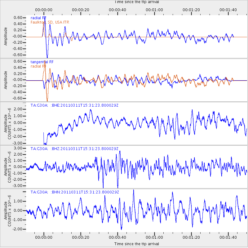
G30A Faulkton, SD, USA - Earthquake Result Viewer
*The percent match for this event was below the threshold and hence no stack was calculated.
| Earthquake location: |
Near East Coast Of Honshu, Japan |
| Earthquake latitude/longitude: |
36.2/141.9 |
| Earthquake time(UTC): |
2011/03/11 (070) 15:19:38 GMT |
| Earthquake Depth: |
35 km |
| Earthquake Magnitude: |
5.5 MB |
| Earthquake Catalog/Contributor: |
WHDF/NEIC |
|
| Network: |
TA USArray Transportable Network (new EarthScope stations) |
| Station: |
G30A Faulkton, SD, USA |
| Lat/Lon: |
45.13 N/99.14 W |
| Elevation: |
496 m |
|
| Distance: |
82.0 deg |
| Az: |
38.693 deg |
| Baz: |
314.448 deg |
| Ray Param: |
$rayparam |
*The percent match for this event was below the threshold and hence was not used in the summary stack. |
|
| Radial Match: |
72.010574 % |
| Radial Bump: |
400 |
| Transverse Match: |
68.695145 % |
| Transverse Bump: |
400 |
| SOD ConfigId: |
356183 |
| Insert Time: |
2011-08-17 04:57:25.435 +0000 |
| GWidth: |
2.5 |
| Max Bumps: |
400 |
| Tol: |
0.001 |
|
Signal To Noise
| Channel | StoN | STA | LTA |
| TA:G30A: :BHZ:20110311T15:31:23.800029Z | 0.89385194 | 4.4296897E-7 | 4.955731E-7 |
| TA:G30A: :BHN:20110311T15:31:23.800029Z | 0.7843849 | 4.7114136E-7 | 6.006507E-7 |
| TA:G30A: :BHE:20110311T15:31:23.800029Z | 0.972657 | 1.0961255E-6 | 1.1269394E-6 |
| Arrivals |
| Ps | |
| PpPs | |
| PsPs/PpSs | |


