You are here: Home > Network List > TA - USArray Transportable Network (new EarthScope stations) Stations List
> Station A04D Lummi Island, WA, USA > Earthquake Result Viewer
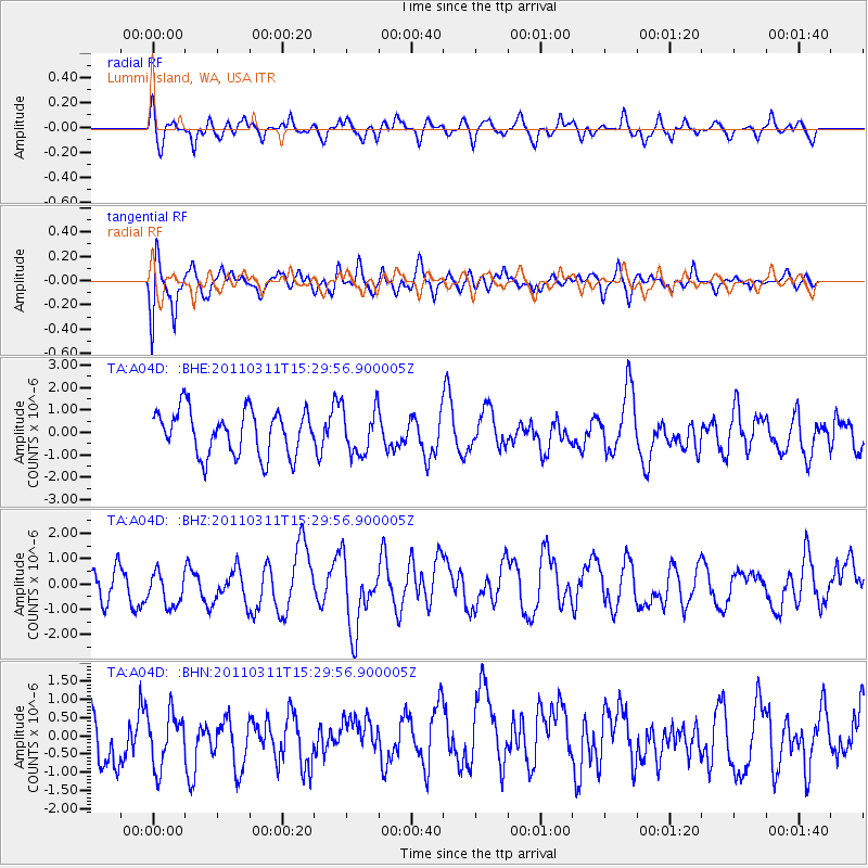
A04D Lummi Island, WA, USA - Earthquake Result Viewer
*The percent match for this event was below the threshold and hence no stack was calculated.
| Earthquake location: |
Near East Coast Of Honshu, Japan |
| Earthquake latitude/longitude: |
36.2/141.9 |
| Earthquake time(UTC): |
2011/03/11 (070) 15:19:38 GMT |
| Earthquake Depth: |
35 km |
| Earthquake Magnitude: |
5.5 MB |
| Earthquake Catalog/Contributor: |
WHDF/NEIC |
|
| Network: |
TA USArray Transportable Network (new EarthScope stations) |
| Station: |
A04D Lummi Island, WA, USA |
| Lat/Lon: |
48.72 N/122.71 W |
| Elevation: |
13 m |
|
| Distance: |
67.0 deg |
| Az: |
45.731 deg |
| Baz: |
299.064 deg |
| Ray Param: |
$rayparam |
*The percent match for this event was below the threshold and hence was not used in the summary stack. |
|
| Radial Match: |
49.932568 % |
| Radial Bump: |
400 |
| Transverse Match: |
64.2059 % |
| Transverse Bump: |
400 |
| SOD ConfigId: |
356183 |
| Insert Time: |
2011-08-17 05:21:14.567 +0000 |
| GWidth: |
2.5 |
| Max Bumps: |
400 |
| Tol: |
0.001 |
|
Signal To Noise
| Channel | StoN | STA | LTA |
| TA:A04D: :BHZ:20110311T15:29:56.900005Z | 0.9357201 | 1.2674775E-6 | 1.3545477E-6 |
| TA:A04D: :BHN:20110311T15:29:56.900005Z | 0.75247157 | 8.164326E-7 | 1.0850011E-6 |
| TA:A04D: :BHE:20110311T15:29:56.900005Z | 1.0333987 | 1.0261484E-6 | 9.929839E-7 |
| Arrivals |
| Ps | |
| PpPs | |
| PsPs/PpSs | |


