You are here: Home > Network List > TA - USArray Transportable Network (new EarthScope stations) Stations List
> Station 143A Socs Landing, Pioneer, LA, USA > Earthquake Result Viewer
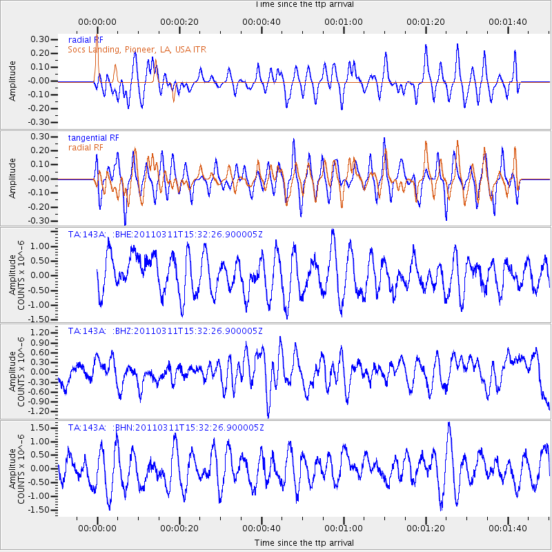
143A Socs Landing, Pioneer, LA, USA - Earthquake Result Viewer
*The percent match for this event was below the threshold and hence no stack was calculated.
| Earthquake location: |
Near East Coast Of Honshu, Japan |
| Earthquake latitude/longitude: |
36.2/141.9 |
| Earthquake time(UTC): |
2011/03/11 (070) 15:19:38 GMT |
| Earthquake Depth: |
35 km |
| Earthquake Magnitude: |
5.5 MB |
| Earthquake Catalog/Contributor: |
WHDF/NEIC |
|
| Network: |
TA USArray Transportable Network (new EarthScope stations) |
| Station: |
143A Socs Landing, Pioneer, LA, USA |
| Lat/Lon: |
32.70 N/91.40 W |
| Elevation: |
30 m |
|
| Distance: |
95.2 deg |
| Az: |
42.724 deg |
| Baz: |
319.421 deg |
| Ray Param: |
$rayparam |
*The percent match for this event was below the threshold and hence was not used in the summary stack. |
|
| Radial Match: |
52.016735 % |
| Radial Bump: |
400 |
| Transverse Match: |
35.13007 % |
| Transverse Bump: |
400 |
| SOD ConfigId: |
356183 |
| Insert Time: |
2011-08-17 05:38:28.258 +0000 |
| GWidth: |
2.5 |
| Max Bumps: |
400 |
| Tol: |
0.001 |
|
Signal To Noise
| Channel | StoN | STA | LTA |
| TA:143A: :BHZ:20110311T15:32:26.900005Z | 1.0964315 | 6.5972546E-7 | 6.0170237E-7 |
| TA:143A: :BHN:20110311T15:32:26.900005Z | 1.7034146 | 9.051089E-7 | 5.3134977E-7 |
| TA:143A: :BHE:20110311T15:32:26.900005Z | 0.56623316 | 3.5114363E-7 | 6.201396E-7 |
| Arrivals |
| Ps | |
| PpPs | |
| PsPs/PpSs | |


