You are here: Home > Network List > US - United States National Seismic Network Stations List
> Station TPNV Topopah Spring, Nevada, USA > Earthquake Result Viewer
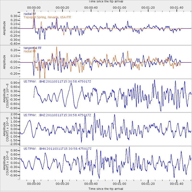
TPNV Topopah Spring, Nevada, USA - Earthquake Result Viewer
*The percent match for this event was below the threshold and hence no stack was calculated.
| Earthquake location: |
Near East Coast Of Honshu, Japan |
| Earthquake latitude/longitude: |
36.2/141.9 |
| Earthquake time(UTC): |
2011/03/11 (070) 15:19:38 GMT |
| Earthquake Depth: |
35 km |
| Earthquake Magnitude: |
5.5 MB |
| Earthquake Catalog/Contributor: |
WHDF/NEIC |
|
| Network: |
US United States National Seismic Network |
| Station: |
TPNV Topopah Spring, Nevada, USA |
| Lat/Lon: |
36.95 N/116.25 W |
| Elevation: |
1600 m |
|
| Distance: |
77.4 deg |
| Az: |
53.454 deg |
| Baz: |
305.839 deg |
| Ray Param: |
$rayparam |
*The percent match for this event was below the threshold and hence was not used in the summary stack. |
|
| Radial Match: |
58.98727 % |
| Radial Bump: |
400 |
| Transverse Match: |
52.50824 % |
| Transverse Bump: |
400 |
| SOD ConfigId: |
356183 |
| Insert Time: |
2011-08-17 05:40:56.317 +0000 |
| GWidth: |
2.5 |
| Max Bumps: |
400 |
| Tol: |
0.001 |
|
Signal To Noise
| Channel | StoN | STA | LTA |
| US:TPNV: :BHZ:20110311T15:30:58.475017Z | 1.5127877 | 7.342886E-7 | 4.853878E-7 |
| US:TPNV: :BHN:20110311T15:30:58.475017Z | 1.1893351 | 4.041523E-7 | 3.3981365E-7 |
| US:TPNV: :BHE:20110311T15:30:58.475017Z | 1.5462408 | 5.1086226E-7 | 3.3038984E-7 |
| Arrivals |
| Ps | |
| PpPs | |
| PsPs/PpSs | |


