You are here: Home > Network List > KN - Kyrgyz Seismic Telemetry Network Stations List
> Station TKM2 KN.TKM2 > Earthquake Result Viewer
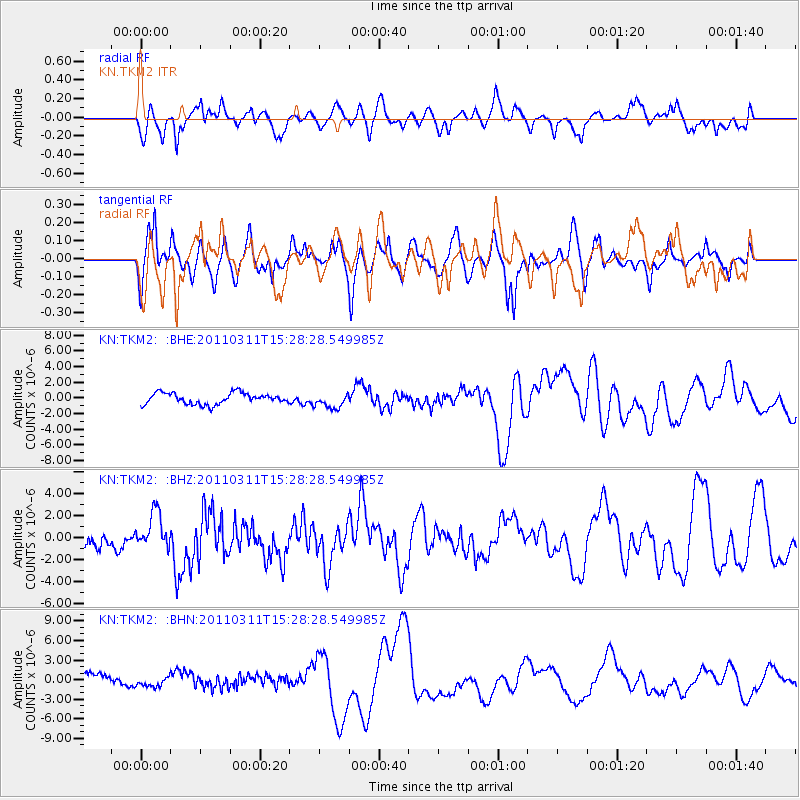
TKM2 KN.TKM2 - Earthquake Result Viewer
*The percent match for this event was below the threshold and hence no stack was calculated.
| Earthquake location: |
Near East Coast Of Honshu, Japan |
| Earthquake latitude/longitude: |
36.4/141.9 |
| Earthquake time(UTC): |
2011/03/11 (070) 15:20:08 GMT |
| Earthquake Depth: |
53 km |
| Earthquake Magnitude: |
6.0 MB |
| Earthquake Catalog/Contributor: |
WHDF/NEIC |
|
| Network: |
KN Kyrgyz Seismic Telemetry Network |
| Station: |
TKM2 KN.TKM2 |
| Lat/Lon: |
42.92 N/75.60 E |
| Elevation: |
2020 m |
|
| Distance: |
50.3 deg |
| Az: |
299.002 deg |
| Baz: |
73.866 deg |
| Ray Param: |
$rayparam |
*The percent match for this event was below the threshold and hence was not used in the summary stack. |
|
| Radial Match: |
62.159733 % |
| Radial Bump: |
400 |
| Transverse Match: |
43.29317 % |
| Transverse Bump: |
376 |
| SOD ConfigId: |
356183 |
| Insert Time: |
2011-08-17 06:39:41.022 +0000 |
| GWidth: |
2.5 |
| Max Bumps: |
400 |
| Tol: |
0.001 |
|
Signal To Noise
| Channel | StoN | STA | LTA |
| KN:TKM2: :BHZ:20110311T15:28:28.549985Z | 0.72505087 | 1.3988312E-6 | 1.929287E-6 |
| KN:TKM2: :BHN:20110311T15:28:28.549985Z | 0.69517165 | 6.2582154E-7 | 9.002403E-7 |
| KN:TKM2: :BHE:20110311T15:28:28.549985Z | 1.3595371 | 9.680489E-7 | 7.12043E-7 |
| Arrivals |
| Ps | |
| PpPs | |
| PsPs/PpSs | |


