You are here: Home > Network List > TA - USArray Transportable Network (new EarthScope stations) Stations List
> Station J01E Myrtle Point, OR, USA > Earthquake Result Viewer
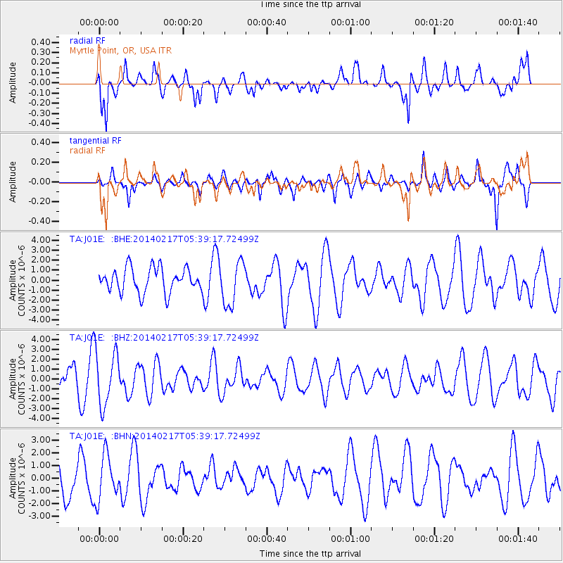
J01E Myrtle Point, OR, USA - Earthquake Result Viewer
*The percent match for this event was below the threshold and hence no stack was calculated.
| Earthquake location: |
Tonga Islands Region |
| Earthquake latitude/longitude: |
-22.4/-174.9 |
| Earthquake time(UTC): |
2014/02/17 (048) 05:27:40 GMT |
| Earthquake Depth: |
31 km |
| Earthquake Magnitude: |
5.4 MW |
| Earthquake Catalog/Contributor: |
ISC/ISC |
|
| Network: |
TA USArray Transportable Network (new EarthScope stations) |
| Station: |
J01E Myrtle Point, OR, USA |
| Lat/Lon: |
43.16 N/123.93 W |
| Elevation: |
128 m |
|
| Distance: |
80.4 deg |
| Az: |
35.231 deg |
| Baz: |
226.838 deg |
| Ray Param: |
$rayparam |
*The percent match for this event was below the threshold and hence was not used in the summary stack. |
|
| Radial Match: |
68.70577 % |
| Radial Bump: |
400 |
| Transverse Match: |
46.711777 % |
| Transverse Bump: |
365 |
| SOD ConfigId: |
3390531 |
| Insert Time: |
2019-04-10 08:46:06.399 +0000 |
| GWidth: |
2.5 |
| Max Bumps: |
400 |
| Tol: |
0.001 |
|
Signal To Noise
| Channel | StoN | STA | LTA |
| TA:J01E: :BHZ:20140217T05:39:17.72499Z | 1.7449005 | 2.6478247E-6 | 1.5174646E-6 |
| TA:J01E: :BHN:20140217T05:39:17.72499Z | 1.4191511 | 1.771951E-6 | 1.2485993E-6 |
| TA:J01E: :BHE:20140217T05:39:17.72499Z | 1.8109813 | 2.2072165E-6 | 1.218796E-6 |
| Arrivals |
| Ps | |
| PpPs | |
| PsPs/PpSs | |


