You are here: Home > Network List > KN - Kyrgyz Seismic Telemetry Network Stations List
> Station CHM KN.CHM > Earthquake Result Viewer
CHM KN.CHM - Earthquake Result Viewer
*The percent match for this event was below the threshold and hence no stack was calculated.
| Earthquake location: |
Luzon, Philippines |
| Earthquake latitude/longitude: |
18.5/120.4 |
| Earthquake time(UTC): |
2014/02/17 (048) 05:55:59 GMT |
| Earthquake Depth: |
20 km |
| Earthquake Magnitude: |
5.5 MWW, 5.5 MWB, 5.6 MWC |
| Earthquake Catalog/Contributor: |
NEIC PDE/NEIC COMCAT |
|
| Network: |
KN Kyrgyz Seismic Telemetry Network |
| Station: |
CHM KN.CHM |
| Lat/Lon: |
43.00 N/74.75 E |
| Elevation: |
655 m |
|
| Distance: |
45.5 deg |
| Az: |
312.613 deg |
| Baz: |
107.866 deg |
| Ray Param: |
$rayparam |
*The percent match for this event was below the threshold and hence was not used in the summary stack. |
|
| Radial Match: |
62.553177 % |
| Radial Bump: |
400 |
| Transverse Match: |
61.35828 % |
| Transverse Bump: |
400 |
| SOD ConfigId: |
3390531 |
| Insert Time: |
2019-04-10 08:48:34.866 +0000 |
| GWidth: |
2.5 |
| Max Bumps: |
400 |
| Tol: |
0.001 |
|
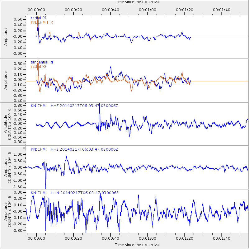
Signal To Noise
| Channel | StoN | STA | LTA |
| KN:CHM: :HHZ:20140217T06:03:47.030006Z | 2.4095478 | 2.561787E-7 | 1.06318176E-7 |
| KN:CHM: :HHN:20140217T06:03:47.030006Z | 1.8107834 | 1.4712235E-7 | 8.12479E-8 |
| KN:CHM: :HHE:20140217T06:03:47.030006Z | 1.6948714 | 1.2140015E-7 | 7.1627944E-8 |
| Arrivals |
| Ps | |
| PpPs | |
| PsPs/PpSs | |


