You are here: Home > Network List > TA - USArray Transportable Network (new EarthScope stations) Stations List
> Station Z34A Collier Ranch, Chico, TX, USA > Earthquake Result Viewer
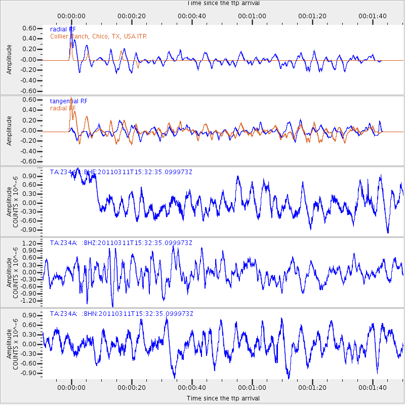
Z34A Collier Ranch, Chico, TX, USA - Earthquake Result Viewer
*The percent match for this event was below the threshold and hence no stack was calculated.
| Earthquake location: |
Near East Coast Of Honshu, Japan |
| Earthquake latitude/longitude: |
36.4/141.9 |
| Earthquake time(UTC): |
2011/03/11 (070) 15:20:08 GMT |
| Earthquake Depth: |
53 km |
| Earthquake Magnitude: |
6.0 MB |
| Earthquake Catalog/Contributor: |
WHDF/NEIC |
|
| Network: |
TA USArray Transportable Network (new EarthScope stations) |
| Station: |
Z34A Collier Ranch, Chico, TX, USA |
| Lat/Lon: |
33.37 N/97.92 W |
| Elevation: |
341 m |
|
| Distance: |
90.9 deg |
| Az: |
46.318 deg |
| Baz: |
315.793 deg |
| Ray Param: |
$rayparam |
*The percent match for this event was below the threshold and hence was not used in the summary stack. |
|
| Radial Match: |
52.115078 % |
| Radial Bump: |
329 |
| Transverse Match: |
44.464684 % |
| Transverse Bump: |
400 |
| SOD ConfigId: |
356183 |
| Insert Time: |
2011-08-17 07:14:41.884 +0000 |
| GWidth: |
2.5 |
| Max Bumps: |
400 |
| Tol: |
0.001 |
|
Signal To Noise
| Channel | StoN | STA | LTA |
| TA:Z34A: :BHZ:20110311T15:32:35.099973Z | 0.98760056 | 4.101998E-7 | 4.153499E-7 |
| TA:Z34A: :BHN:20110311T15:32:35.099973Z | 0.56532526 | 1.6113378E-7 | 2.8502845E-7 |
| TA:Z34A: :BHE:20110311T15:32:35.099973Z | 0.8223364 | 4.1810952E-7 | 5.0844096E-7 |
| Arrivals |
| Ps | |
| PpPs | |
| PsPs/PpSs | |


