You are here: Home > Network List > TA - USArray Transportable Network (new EarthScope stations) Stations List
> Station S36A Lake Cedric, Chanute, KS, USA > Earthquake Result Viewer
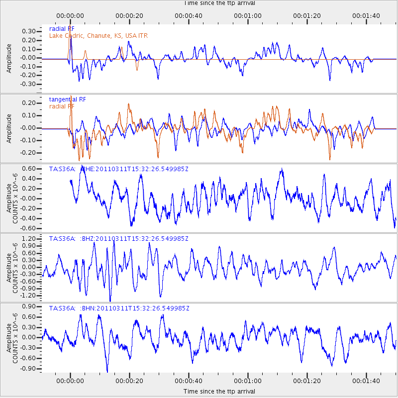
S36A Lake Cedric, Chanute, KS, USA - Earthquake Result Viewer
*The percent match for this event was below the threshold and hence no stack was calculated.
| Earthquake location: |
Near East Coast Of Honshu, Japan |
| Earthquake latitude/longitude: |
36.4/141.9 |
| Earthquake time(UTC): |
2011/03/11 (070) 15:20:08 GMT |
| Earthquake Depth: |
53 km |
| Earthquake Magnitude: |
6.0 MB |
| Earthquake Catalog/Contributor: |
WHDF/NEIC |
|
| Network: |
TA USArray Transportable Network (new EarthScope stations) |
| Station: |
S36A Lake Cedric, Chanute, KS, USA |
| Lat/Lon: |
37.72 N/95.59 W |
| Elevation: |
299 m |
|
| Distance: |
89.1 deg |
| Az: |
41.953 deg |
| Baz: |
317.14 deg |
| Ray Param: |
$rayparam |
*The percent match for this event was below the threshold and hence was not used in the summary stack. |
|
| Radial Match: |
50.265617 % |
| Radial Bump: |
400 |
| Transverse Match: |
52.49037 % |
| Transverse Bump: |
377 |
| SOD ConfigId: |
356183 |
| Insert Time: |
2011-08-17 07:20:41.457 +0000 |
| GWidth: |
2.5 |
| Max Bumps: |
400 |
| Tol: |
0.001 |
|
Signal To Noise
| Channel | StoN | STA | LTA |
| TA:S36A: :BHZ:20110311T15:32:26.549985Z | 1.2557151 | 5.526049E-7 | 4.4007186E-7 |
| TA:S36A: :BHN:20110311T15:32:26.549985Z | 1.2146258 | 2.78362E-7 | 2.2917511E-7 |
| TA:S36A: :BHE:20110311T15:32:26.549985Z | 1.4133192 | 3.7502514E-7 | 2.6535062E-7 |
| Arrivals |
| Ps | |
| PpPs | |
| PsPs/PpSs | |


