You are here: Home > Network List > TA - USArray Transportable Network (new EarthScope stations) Stations List
> Station O33A Hebron, NE, USA > Earthquake Result Viewer
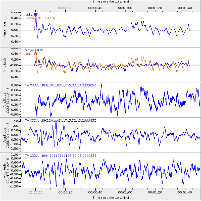
O33A Hebron, NE, USA - Earthquake Result Viewer
*The percent match for this event was below the threshold and hence no stack was calculated.
| Earthquake location: |
Near East Coast Of Honshu, Japan |
| Earthquake latitude/longitude: |
36.4/141.9 |
| Earthquake time(UTC): |
2011/03/11 (070) 15:20:08 GMT |
| Earthquake Depth: |
53 km |
| Earthquake Magnitude: |
6.0 MB |
| Earthquake Catalog/Contributor: |
WHDF/NEIC |
|
| Network: |
TA USArray Transportable Network (new EarthScope stations) |
| Station: |
O33A Hebron, NE, USA |
| Lat/Lon: |
40.08 N/97.58 W |
| Elevation: |
480 m |
|
| Distance: |
86.3 deg |
| Az: |
41.465 deg |
| Baz: |
315.874 deg |
| Ray Param: |
$rayparam |
*The percent match for this event was below the threshold and hence was not used in the summary stack. |
|
| Radial Match: |
63.636997 % |
| Radial Bump: |
345 |
| Transverse Match: |
58.184258 % |
| Transverse Bump: |
400 |
| SOD ConfigId: |
356183 |
| Insert Time: |
2011-08-17 07:27:42.193 +0000 |
| GWidth: |
2.5 |
| Max Bumps: |
400 |
| Tol: |
0.001 |
|
Signal To Noise
| Channel | StoN | STA | LTA |
| TA:O33A: :BHZ:20110311T15:32:13.299985Z | 1.227752 | 5.762959E-7 | 4.6939118E-7 |
| TA:O33A: :BHN:20110311T15:32:13.299985Z | 1.1046121 | 4.777801E-7 | 4.32532E-7 |
| TA:O33A: :BHE:20110311T15:32:13.299985Z | 1.3046052 | 3.8870473E-7 | 2.9794816E-7 |
| Arrivals |
| Ps | |
| PpPs | |
| PsPs/PpSs | |


